

174
D. Koslowsky
10
5
o
5
10
15
20
25
30
35
40
55
55
r---~----+----4----~~45
40~~~~--4-----~~~----~~~~---+----4-----~---+~40
35~---+----+----+~
~--+----+----+----4----4---~~35
3O~---+----+----+----+----4----4---~~--~----~--~~30
-
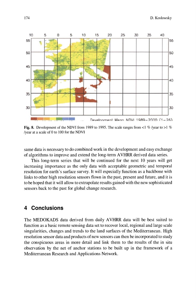
Fig. 8. Development of the NDVI from 1989 to 1995. The scale ranges from <1 % /year to > 1 %
/year at a scale of 0 to 100 for the ND VI
same data is necessary to do combined work in the development and easy exchange
of algorithms to improve and extend the long-term A VHRR derived data series.
This long-term series that will be continued for the next 10 years will get
increasing importance as the only data with acceptable geometric and temporal
resolution for earth's surface survey. It will especially function as a backbone with
links to other high resolution sensors flown in the past, present and future, and it is
to be hoped that it will allow to extrapolate results gained with the new sophisticated
sensors back to the past for global change research.
4 Conclusions
The MEDOKADS data derived from daily A VHRR data will be best suited to
function as a basic remote sensing data set to recover local, regional and large scale
singularities, changes and trends to the land surfaces of the Mediterranean. High
resolution sensor data and products of new sensors can then be incorporated to study
the conspicuous areas in more detail and link them to the results of the in situ
observation by the net of anchor stations to be built up in the framework of a
Mediterranean Research and Applications Network.
D. Koslowsky
10
5
o
5
10
15
20
25
30
35
40
55
55
r---~----+----4----~~45
40~~~~--4-----~~~----~~~~---+----4-----~---+~40
35~---+----+----+~
~--+----+----+----4----4---~~35
3O~---+----+----+----+----4----4---~~--~----~--~~30
-
Fig. 8. Development of the NDVI from 1989 to 1995. The scale ranges from <1 % /year to > 1 %
/year at a scale of 0 to 100 for the ND VI
same data is necessary to do combined work in the development and easy exchange
of algorithms to improve and extend the long-term A VHRR derived data series.
This long-term series that will be continued for the next 10 years will get
increasing importance as the only data with acceptable geometric and temporal
resolution for earth's surface survey. It will especially function as a backbone with
links to other high resolution sensors flown in the past, present and future, and it is
to be hoped that it will allow to extrapolate results gained with the new sophisticated
sensors back to the past for global change research.
4 Conclusions
The MEDOKADS data derived from daily A VHRR data will be best suited to
function as a basic remote sensing data set to recover local, regional and large scale
singularities, changes and trends to the land surfaces of the Mediterranean. High
resolution sensor data and products of new sensors can then be incorporated to study
the conspicuous areas in more detail and link them to the results of the in situ
observation by the net of anchor stations to be built up in the framework of a
Mediterranean Research and Applications Network.