

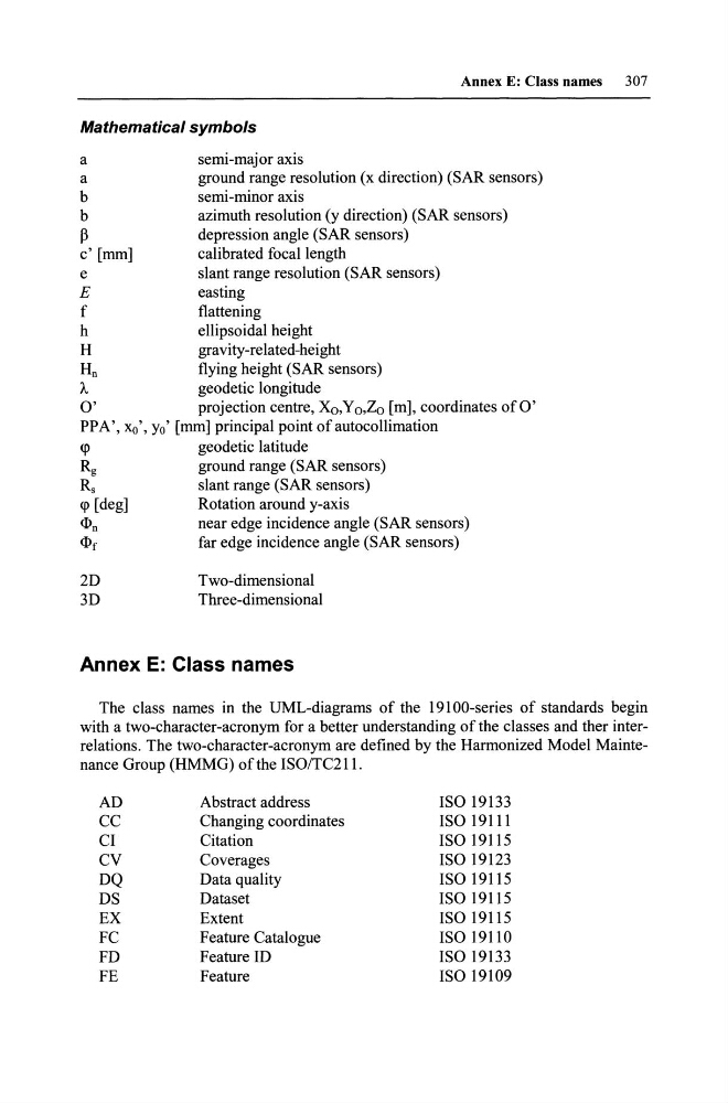
Annex E: Class names
307
Mathematical symbols
a
semi-major axis
a
ground range resolution (x direction) (SAR sensors)
b
semi-minor axis
b
azimuth resolution (y direction) (SAR sensors)
ß
depression angle (SAR sensors)
c' [mm]
ca1ibrated foca11ength
e
slant range resolution (SAR sensors)
E
easting
f
flattening
h
ellipsoida1 height
H
gravity-re1ated-height
Hn
flying height (SAR sensors)
A
geodetic 10ngitude
0'
projection centre, Xo,Yo,Zo [m], coordinates ofO'
PPA', xo', Yo' [mm] principa1 point ofautocollimation
Rg
ground range (SAR sensors)
Rs
slant range (SAR sensors)
Rotation around y-axis
n
near edge incidence angle (SAR sensors)
[
far edge incidence angle (SAR sensors)
2D
3D
Two-dimensiona1
Three-dimensiona1
Annex E: Class names
The class names in the UML-diagrams of the 19100-series of standards begin
with a two-character-acronym for a better understanding of the classes and ther interrelations. The two-character-acronym are defined by the Harmonized Model Maintenance Group (HMMG) ofthe ISOITC211.
AD
Abstract address
ISO 19133
CC
Changing coordinates
ISO 19111
CI
Citation
ISO 19115
CV
Coverages
ISO 19123
DQ
Data qua1ity
ISO 19115
DS
Dataset
ISO 19115
EX
Extent
ISO 19115
FC
Feature Cata10gue
ISO 19110
FD
Feature ID
ISO 19133
FE
Feature
ISO 19109
307
Mathematical symbols
a
semi-major axis
a
ground range resolution (x direction) (SAR sensors)
b
semi-minor axis
b
azimuth resolution (y direction) (SAR sensors)
ß
depression angle (SAR sensors)
c' [mm]
ca1ibrated foca11ength
e
slant range resolution (SAR sensors)
E
easting
f
flattening
h
ellipsoida1 height
H
gravity-re1ated-height
Hn
flying height (SAR sensors)
A
geodetic 10ngitude
0'
projection centre, Xo,Yo,Zo [m], coordinates ofO'
PPA', xo', Yo' [mm] principa1 point ofautocollimation
Rg
ground range (SAR sensors)
Rs
slant range (SAR sensors)
Rotation around y-axis
near edge incidence angle (SAR sensors)
far edge incidence angle (SAR sensors)
2D
3D
Two-dimensiona1
Three-dimensiona1
Annex E: Class names
The class names in the UML-diagrams of the 19100-series of standards begin
with a two-character-acronym for a better understanding of the classes and ther interrelations. The two-character-acronym are defined by the Harmonized Model Maintenance Group (HMMG) ofthe ISOITC211.
AD
Abstract address
ISO 19133
CC
Changing coordinates
ISO 19111
CI
Citation
ISO 19115
CV
Coverages
ISO 19123
DQ
Data qua1ity
ISO 19115
DS
Dataset
ISO 19115
EX
Extent
ISO 19115
FC
Feature Cata10gue
ISO 19110
FD
Feature ID
ISO 19133
FE
Feature
ISO 19109