

Monitoring of Pollution by Means of Remote Sensing
527
1988 under the Plan for Monitoring Andalucian Coastal Waters. With the general aim
of knowing the level of contamination of Andalucian coastal waters, samples of water
and sediments were taken throughout the whole coast of Andalucía, including the tidal
reaches of rivers.
For water, the aspect on which this chapter is concentrated, monitoring was
based on analysis of samples from 133 sites, 73 in the sea and 56 in tidal reaches of
rivers. The samples were analysed for copper, zinc, manganese, nickel, chromium,
cadmium, lead, arsenic, mercury, pH, conductivity, suspended solids, dissolved
oxygen, chemical oxygen demand, total coliforms, nitrite, nitrate, ammonia,
phosphates, oils and greases, cyanide, fluoride, and phenols. The location of sample
sites took into account the possible impact of human activity so that there was a greater
concentration of sample sites in the more sensitive areas. Also depending on the
sensitivity of the area and its exposure to contamination, the sampling was quarterly,
bi-annual, or annual. Furthermore, in the zone affected by significant tides, the
Atlantic coast, each sampling was made at both high and low water.
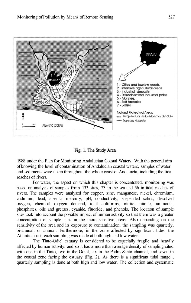
The Tinto-Odiel estuary is considered to be especially fragile and heavily
affected by human activity, and so it has a more than average density of sampling sites,
with one in the Tinto, two in the Odiel, six in the Padre Santo channel, and seven in
the coastal zone facing the estuary (Fig. 2). As there is a significant tidal range ,
quarterly sampling is done at both high and low water. The collection and systematic
527
1988 under the Plan for Monitoring Andalucian Coastal Waters. With the general aim
of knowing the level of contamination of Andalucian coastal waters, samples of water
and sediments were taken throughout the whole coast of Andalucía, including the tidal
reaches of rivers.
For water, the aspect on which this chapter is concentrated, monitoring was
based on analysis of samples from 133 sites, 73 in the sea and 56 in tidal reaches of
rivers. The samples were analysed for copper, zinc, manganese, nickel, chromium,
cadmium, lead, arsenic, mercury, pH, conductivity, suspended solids, dissolved
oxygen, chemical oxygen demand, total coliforms, nitrite, nitrate, ammonia,
phosphates, oils and greases, cyanide, fluoride, and phenols. The location of sample
sites took into account the possible impact of human activity so that there was a greater
concentration of sample sites in the more sensitive areas. Also depending on the
sensitivity of the area and its exposure to contamination, the sampling was quarterly,
bi-annual, or annual. Furthermore, in the zone affected by significant tides, the
Atlantic coast, each sampling was made at both high and low water.
The Tinto-Odiel estuary is considered to be especially fragile and heavily
affected by human activity, and so it has a more than average density of sampling sites,
with one in the Tinto, two in the Odiel, six in the Padre Santo channel, and seven in
the coastal zone facing the estuary (Fig. 2). As there is a significant tidal range ,
quarterly sampling is done at both high and low water. The collection and systematic