

CHAPTER 36
Submerged Kelp Biomass Assessment using CASI
É. L. Simms
ABSTRACT: Remote sensing is an effective data source for location of submerged
kelp beds. However, biomass assessment must be supported by in situ data. This
chapter presents a method to estimate the biomass from remote sensing images. The
method takes advantage of the synoptic coverage offered by remote sensing and the
local variability of biomass measurable through field surveys. An application is
presented with an airborne image of the south coast of Newfoundland, Canada. It is
shown that biomass estimates vary with the species present in dense kelp beds. The
biomass estaimates based on the entire survey is 802 ± 517 metric tons (t). However,
an estimate of 1501 ± 77 t takes into account the species dominating the surveyed
quadrats.
Introduction
The ecology and biology of submerged marine kelp beds have historically been
obtained through field surveys, scuba diving, and laboratory analyses. Remote sensing
data provide means to extract information on the location and the biomass of
submerged kelp beds (Lambert et al., 1984; Belsher et al., 1996). In situ data are
usually considered the standard against which the accuracy of remote sensing biomass
assessments are compared. The spatial resolution and the expression of the biomass
obtained from the in-situ data is often incompatible with the remote sensing data. Field
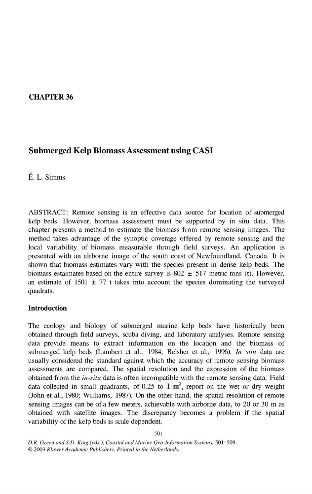
data collected in small quadrants, of 0.25 to
report on the wet or dry weight
(John et al., 1980; Williams, 1987). On the other hand, the spatial resolution of remote
sensing images can be of a few meters, achievable with airborne data, to 20 or 30 m as
obtained with satellite images. The discrepancy becomes a problem if the spatial
variability of the kelp beds is scale dependent.
501
D.R. Green and S.D. King (eds.), Coastal and Marine Geo-Information Systems, 501–509.
© 2003 Kluwer Academic Publishers. Printed in the Netherlands.
Submerged Kelp Biomass Assessment using CASI
É. L. Simms
ABSTRACT: Remote sensing is an effective data source for location of submerged
kelp beds. However, biomass assessment must be supported by in situ data. This
chapter presents a method to estimate the biomass from remote sensing images. The
method takes advantage of the synoptic coverage offered by remote sensing and the
local variability of biomass measurable through field surveys. An application is
presented with an airborne image of the south coast of Newfoundland, Canada. It is
shown that biomass estimates vary with the species present in dense kelp beds. The
biomass estaimates based on the entire survey is 802 ± 517 metric tons (t). However,
an estimate of 1501 ± 77 t takes into account the species dominating the surveyed
quadrats.
Introduction
The ecology and biology of submerged marine kelp beds have historically been
obtained through field surveys, scuba diving, and laboratory analyses. Remote sensing
data provide means to extract information on the location and the biomass of
submerged kelp beds (Lambert et al., 1984; Belsher et al., 1996). In situ data are
usually considered the standard against which the accuracy of remote sensing biomass
assessments are compared. The spatial resolution and the expression of the biomass
obtained from the in-situ data is often incompatible with the remote sensing data. Field
data collected in small quadrants, of 0.25 to
report on the wet or dry weight
(John et al., 1980; Williams, 1987). On the other hand, the spatial resolution of remote
sensing images can be of a few meters, achievable with airborne data, to 20 or 30 m as
obtained with satellite images. The discrepancy becomes a problem if the spatial
variability of the kelp beds is scale dependent.
501
D.R. Green and S.D. King (eds.), Coastal and Marine Geo-Information Systems, 501–509.
© 2003 Kluwer Academic Publishers. Printed in the Netherlands.