

Predicting the Distribution of Marine Benthic Biotopes
489
chart datum (bcd). The shores are rugged and predominantly rocky, with high cliffs to
the west, lower cliffs to the east, numerous stacks, arches and caves, and several
islands and offshore skerries. In the shallow sublittoral (down to around 20 m bcd) the
substratum is largely rugged bedrock with coarse mobile sand. Offshore the
substratum is predominantly coarse sands and gravels with low outcrops of bedrock.
The main island of Papa Stour also has four shallow voes or inlets, which provide
shelter from prevailing wind and waves.
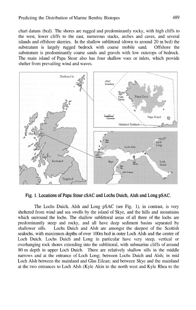
The Lochs Duich, Alsh and Long pSAC (see Fig. 1), in contrast, is very
sheltered from wind and sea swells by the island of Skye, and the hills and mountains
which surround the lochs. The shallow sublittoral areas of all three of the lochs are
predominantly steep and rocky, and all have deep sediment basins separated by
shallower sills.
Lochs Duich and Alsh are amongst the deepest of the Scottish
sealochs, with maximum depths of over 100m bcd in outer Loch Alsh and the centre of
Loch Duich. Lochs Duich and Long in particular have very steep, vertical or
overhanging rock shores extending into the sublittoral, with submarine cliffs of around
80 m depth in upper Loch Duich. There are relatively shallow sills in the middle
narrows and at the entrance of Loch Long; between Lochs Duich and Alsh; in mid
Loch Alsh between the mainland and Glas Eilean; and between Skye and the mainland
at the two entrances to Loch Alsh (Kyle Akin to the north west and Kyle Rhea to the
489
chart datum (bcd). The shores are rugged and predominantly rocky, with high cliffs to
the west, lower cliffs to the east, numerous stacks, arches and caves, and several
islands and offshore skerries. In the shallow sublittoral (down to around 20 m bcd) the
substratum is largely rugged bedrock with coarse mobile sand. Offshore the
substratum is predominantly coarse sands and gravels with low outcrops of bedrock.
The main island of Papa Stour also has four shallow voes or inlets, which provide
shelter from prevailing wind and waves.
The Lochs Duich, Alsh and Long pSAC (see Fig. 1), in contrast, is very
sheltered from wind and sea swells by the island of Skye, and the hills and mountains
which surround the lochs. The shallow sublittoral areas of all three of the lochs are
predominantly steep and rocky, and all have deep sediment basins separated by
shallower sills.
Lochs Duich and Alsh are amongst the deepest of the Scottish
sealochs, with maximum depths of over 100m bcd in outer Loch Alsh and the centre of
Loch Duich. Lochs Duich and Long in particular have very steep, vertical or
overhanging rock shores extending into the sublittoral, with submarine cliffs of around
80 m depth in upper Loch Duich. There are relatively shallow sills in the middle
narrows and at the entrance of Loch Long; between Lochs Duich and Alsh; in mid
Loch Alsh between the mainland and Glas Eilean; and between Skye and the mainland
at the two entrances to Loch Alsh (Kyle Akin to the north west and Kyle Rhea to the