

454
D. R. Green and S. D. King
pasted’ into other software, e.g. data into a spreadsheet, text into a word processor,
graphics into image processing software.
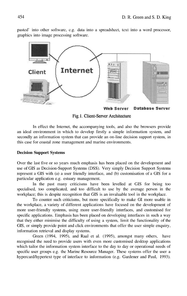
In effect the Internet, the accompanying tools, and also the browsers provide
an ideal environment in which to develop firstly a simple information system, and
secondly an information system that can provide an on-line decision support system, in
this case for coastal zone management and marine environments.
Decision Support Systems
Over the last five or so years much emphasis has been placed on the development and
use of GIS as Decision-Support Systems (DSS). Very simply Decision Support Systems
represent a GIS with (a) a user friendly interface, and (b) customisation of a GIS for a
particular application e.g. estuary management.
In the past many criticisms have been levelled at GIS for being too
specialised, too complicated, and too difficult to use by the average person in the
workplace; this is despite recognition that GIS is an invaluable tool in the workplace.
To counter such criticisms, but more specifically to make GI more usable in
the workplace, a variety of different applications have focused on the development of
more user-friendly systems, using more user-friendly interfaces, and customised for
specific applications. Emphasis has been placed on developing interfaces in such a way
that they either minimise the difficulty of using a system, limit the functionality of the
GIS, or simply provide point and click environments that offer the user simple enquiry,
information retrieval and display systems.
Green (1994, 1995), and Raal et al. (1995), amongst many others, have
recognised the need to provide users with even more customised desktop applications
which tailor the information system interface to the day to day or operational needs of
specific user groups e.g. the Marine Resource Manager. These systems offer the user a
hypercard/hypertext type of interface to information (e.g. Gardener and Paul, 1993).
D. R. Green and S. D. King
pasted’ into other software, e.g. data into a spreadsheet, text into a word processor,
graphics into image processing software.
In effect the Internet, the accompanying tools, and also the browsers provide
an ideal environment in which to develop firstly a simple information system, and
secondly an information system that can provide an on-line decision support system, in
this case for coastal zone management and marine environments.
Decision Support Systems
Over the last five or so years much emphasis has been placed on the development and
use of GIS as Decision-Support Systems (DSS). Very simply Decision Support Systems
represent a GIS with (a) a user friendly interface, and (b) customisation of a GIS for a
particular application e.g. estuary management.
In the past many criticisms have been levelled at GIS for being too
specialised, too complicated, and too difficult to use by the average person in the
workplace; this is despite recognition that GIS is an invaluable tool in the workplace.
To counter such criticisms, but more specifically to make GI more usable in
the workplace, a variety of different applications have focused on the development of
more user-friendly systems, using more user-friendly interfaces, and customised for
specific applications. Emphasis has been placed on developing interfaces in such a way
that they either minimise the difficulty of using a system, limit the functionality of the
GIS, or simply provide point and click environments that offer the user simple enquiry,
information retrieval and display systems.
Green (1994, 1995), and Raal et al. (1995), amongst many others, have
recognised the need to provide users with even more customised desktop applications
which tailor the information system interface to the day to day or operational needs of
specific user groups e.g. the Marine Resource Manager. These systems offer the user a
hypercard/hypertext type of interface to information (e.g. Gardener and Paul, 1993).