

378
K. A. Jenner et al.
The ArcInfo OVERLAYEVENTS command was also used to examine adjacency
relationships. This command compares the along-shore extent of two or more database
tables (referred to as event tables in ArcInfo terminology) which have 'to' and 'from'
distances. Using the INTERSECT subcommand of the OVERLAYEVENTS command,
a resultant database table is created containing records of coastal units which are
common to the event tables chosen for the query. A record is created at every end point
of an event, or
in our case a coastal unit, for all of the input event tables. If any events, or coastal
units, overlap in extent, the total number of events or coastal units will increase in the
resultant database table. For example, a single unit representing a backshore cliff could
be divided into several units, all with the same cliff attributes, if this coastal unit is
overlain with several smaller units in the foreshore. The consequences of this to our
analysis will be discussed below.
Discussion
Adjacency relationship queries were completed separately for the east and the south
coasts of the study area to quantify the predominant form relationships and to use these
relationships to compare and contrast the coastal geomorphology. Binary and tertiary
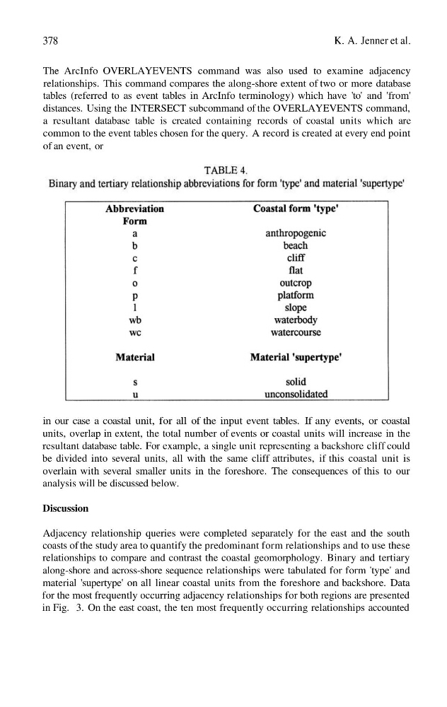
along-shore and across-shore sequence relationships were tabulated for form 'type' and
material 'supertype' on all linear coastal units from the foreshore and backshore. Data
for the most frequently occurring adjacency relationships for both regions are presented
in Fig. 3. On the east coast, the ten most frequently occurring relationships accounted
K. A. Jenner et al.
The ArcInfo OVERLAYEVENTS command was also used to examine adjacency
relationships. This command compares the along-shore extent of two or more database
tables (referred to as event tables in ArcInfo terminology) which have 'to' and 'from'
distances. Using the INTERSECT subcommand of the OVERLAYEVENTS command,
a resultant database table is created containing records of coastal units which are
common to the event tables chosen for the query. A record is created at every end point
of an event, or
in our case a coastal unit, for all of the input event tables. If any events, or coastal
units, overlap in extent, the total number of events or coastal units will increase in the
resultant database table. For example, a single unit representing a backshore cliff could
be divided into several units, all with the same cliff attributes, if this coastal unit is
overlain with several smaller units in the foreshore. The consequences of this to our
analysis will be discussed below.
Discussion
Adjacency relationship queries were completed separately for the east and the south
coasts of the study area to quantify the predominant form relationships and to use these
relationships to compare and contrast the coastal geomorphology. Binary and tertiary
along-shore and across-shore sequence relationships were tabulated for form 'type' and
material 'supertype' on all linear coastal units from the foreshore and backshore. Data
for the most frequently occurring adjacency relationships for both regions are presented
in Fig. 3. On the east coast, the ten most frequently occurring relationships accounted