

291
GIS and Aquaculture: Soft-Shell Clam Site Assessment
can identify and map the areas to cull or harvest as well as evaluate the expected yield
along
a proposed harvest path. These applications can be called prescriptive because the
results of the analysis can be use as rules or guidelines for harvesting clams.
The use of a GIS to develop aquaculture operation scenarios requires the
definition of criterion or rules for a particular activity. In this study the following rules
are used to identify areas for harvesting or culling and they are:
1)
2)
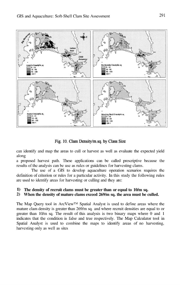
The density of recruit clams must be greater than or equal to 10/m sq.
When the density of mature clams exceed 269/m sq. the area must be culled.
The Map Query tool in ArcView™ Spatial Analyst is used to define areas where the
mature clam density is greater than 269/m sq. and where recruit densities are equal to or
greater than 10/m sq. The result of this analysis is two binary maps where 0 and 1
indicates that the condition is false and true respectively. The Map Calculator tool in
Spatial Analyst is used to combine the maps to identify areas of no harvesting,
harvesting only as well as sites
GIS and Aquaculture: Soft-Shell Clam Site Assessment
can identify and map the areas to cull or harvest as well as evaluate the expected yield
along
a proposed harvest path. These applications can be called prescriptive because the
results of the analysis can be use as rules or guidelines for harvesting clams.
The use of a GIS to develop aquaculture operation scenarios requires the
definition of criterion or rules for a particular activity. In this study the following rules
are used to identify areas for harvesting or culling and they are:
1)
2)
The density of recruit clams must be greater than or equal to 10/m sq.
When the density of mature clams exceed 269/m sq. the area must be culled.
The Map Query tool in ArcView™ Spatial Analyst is used to define areas where the
mature clam density is greater than 269/m sq. and where recruit densities are equal to or
greater than 10/m sq. The result of this analysis is two binary maps where 0 and 1
indicates that the condition is false and true respectively. The Map Calculator tool in
Spatial Analyst is used to combine the maps to identify areas of no harvesting,
harvesting only as well as sites