

Wanless et al.
222
The species we selected as a model was the shag Phalacrocorax aristotelis
which is an important avian predator in the inshore marine community. It is endemic
to the northeast Atlantic and Mediterranean and more than 20% of the world
population breeds in Britain and Ireland (Lloyd et al., 1991). The shag is a footpropelled pursuit diver, that relies heavily on the lesser sandeel Ammodytes marinus as
a food supply (Harris and Wanless, 1991). It is predominantly a benthic feeder
(Wanless et al., 1991a; but see Grémillet et al., in press). In a recent paper we have
described the development of this integrated approach in detail (Wanless et al., 1998),
our aim here is to demonstrate the potential of the technique as a management tool in
coastal systems. Specifically we show how it can be used to: a) help delineate marine
Special Protected Areas (SPAs) b) assess the potential impact of an oil spill; and c)
estimate the effects of a reduction in food availability, such as might be brought about
by overfishing.
Study Area
To demonstrate the GIS approach we selected a study area that encompassed the Firths
of Forth and Tay in southeast Scotland (Fig. 1), an area which holds important
concentrations of shags. The main breeding location is on the Isle of May, with smaller
colonies on many of other islands in the Firth of Forth (Joint Nature Conservation
Committee/Seabird Group Seabird Colony Register). From a management point of
view the area is of particular interest because of its proximity to both the major sandeel
fishing grounds centred on the Wee Bankie (c. 30 km east of the Isle of May) and the
high level of tanker traffic en route to and from the refinery at Grangemouth further up
the Forth estuary. Information on the bathymetry and seabed sediments for the area
was obtained from British Geological Survey maps (BGS, 1986). These data, together
with those on the sizes and locations of seabird breeding colonies, were digitised and
stored in a GIS. The bathymetry (bands of 0-10, 11-20, 21-30 m etc.) and sediment
type polygons (Fig. 2) were intersected and then superimposed on a 1x1 km grid of the
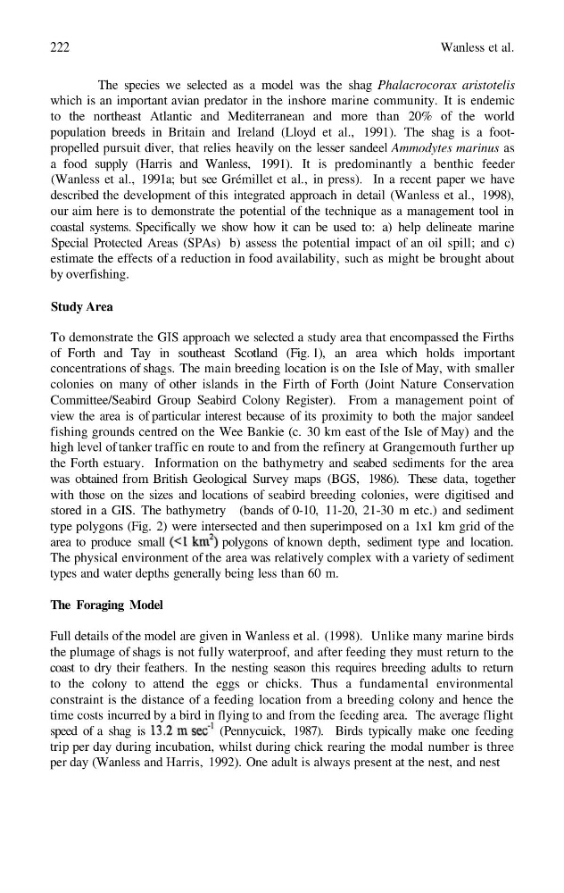
area to produce small
polygons of known depth, sediment type and location.
The physical environment of the area was relatively complex with a variety of sediment
types and water depths generally being less than 60 m.
The Foraging Model
Full details of the model are given in Wanless et al. (1998). Unlike many marine birds
the plumage of shags is not fully waterproof, and after feeding they must return to the
coast to dry their feathers. In the nesting season this requires breeding adults to return
to the colony to attend the eggs or chicks. Thus a fundamental environmental
constraint is the distance of a feeding location from a breeding colony and hence the
time costs incurred by a bird in flying to and from the feeding area. The average flight
speed of a shag is
(Pennycuick, 1987). Birds typically make one feeding
trip per day during incubation, whilst during chick rearing the modal number is three
per day (Wanless and Harris, 1992). One adult is always present at the nest, and nest
222
The species we selected as a model was the shag Phalacrocorax aristotelis
which is an important avian predator in the inshore marine community. It is endemic
to the northeast Atlantic and Mediterranean and more than 20% of the world
population breeds in Britain and Ireland (Lloyd et al., 1991). The shag is a footpropelled pursuit diver, that relies heavily on the lesser sandeel Ammodytes marinus as
a food supply (Harris and Wanless, 1991). It is predominantly a benthic feeder
(Wanless et al., 1991a; but see Grémillet et al., in press). In a recent paper we have
described the development of this integrated approach in detail (Wanless et al., 1998),
our aim here is to demonstrate the potential of the technique as a management tool in
coastal systems. Specifically we show how it can be used to: a) help delineate marine
Special Protected Areas (SPAs) b) assess the potential impact of an oil spill; and c)
estimate the effects of a reduction in food availability, such as might be brought about
by overfishing.
Study Area
To demonstrate the GIS approach we selected a study area that encompassed the Firths
of Forth and Tay in southeast Scotland (Fig. 1), an area which holds important
concentrations of shags. The main breeding location is on the Isle of May, with smaller
colonies on many of other islands in the Firth of Forth (Joint Nature Conservation
Committee/Seabird Group Seabird Colony Register). From a management point of
view the area is of particular interest because of its proximity to both the major sandeel
fishing grounds centred on the Wee Bankie (c. 30 km east of the Isle of May) and the
high level of tanker traffic en route to and from the refinery at Grangemouth further up
the Forth estuary. Information on the bathymetry and seabed sediments for the area
was obtained from British Geological Survey maps (BGS, 1986). These data, together
with those on the sizes and locations of seabird breeding colonies, were digitised and
stored in a GIS. The bathymetry (bands of 0-10, 11-20, 21-30 m etc.) and sediment
type polygons (Fig. 2) were intersected and then superimposed on a 1x1 km grid of the
area to produce small
polygons of known depth, sediment type and location.
The physical environment of the area was relatively complex with a variety of sediment
types and water depths generally being less than 60 m.
The Foraging Model
Full details of the model are given in Wanless et al. (1998). Unlike many marine birds
the plumage of shags is not fully waterproof, and after feeding they must return to the
coast to dry their feathers. In the nesting season this requires breeding adults to return
to the colony to attend the eggs or chicks. Thus a fundamental environmental
constraint is the distance of a feeding location from a breeding colony and hence the
time costs incurred by a bird in flying to and from the feeding area. The average flight
speed of a shag is
(Pennycuick, 1987). Birds typically make one feeding
trip per day during incubation, whilst during chick rearing the modal number is three
per day (Wanless and Harris, 1992). One adult is always present at the nest, and nest