

CHAPTER 15
Tracing the Recent Evolution of the Littoral Spit at El Rompido,
Huelva (Spain) Using Remote Sensing and GIS
J. Ojeda Zújar, E. Parrilla, J.M. Pérez, and J. Loder
ABSTRACT: The El Rompido spit at the mouth of the River Piedras in SW Spain
currently forms a notable example of a right angled estuary. This spectacular
geomorphological unit, and the rapid rate of longitudinal progradation that have
characterized its more recent evolution, has drawn the attention of many investigators.
This chapter summarizes some of the cartographic results of a study of the spit’s recent
evolution using various different data and information sources including maps, charts,
aerial photographs, and satellite images analysed in a GIS.
Introduction
The spit El Rompido at the mouth of the River Piedras in SW Spain currently forms a
notable example of a right angled estuary. The 12km. coastal spit that we see today
has evolved from a system of barrier islands, still active until the late nineteenth
century, which extended from the mouth of the Guadiana river on the Portuguese
border to the Rio Piedras. At the end of the nineteenth century the majority of the tidal
inlets, which separated the barrier islands, began to close, thereby contributing to the
formation of a continuous ridge of coastal dunes which now ends in extreme distal
point of the El Rompido spit. Situated on a very dynamic coast which is subjected to a
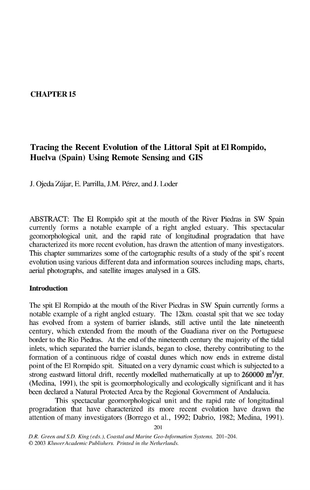
strong eastward littoral drift, recently modelled mathematically at up to
(Medina, 1991), the spit is geomorphologically and ecologically significant and it has
been declared a Natural Protected Area by the Regional Government of Andalucia.
This spectacular geomorphological unit and the rapid rate of longitudinal
progradation that have characterized its more recent evolution have drawn the
attention of many investigators (Borrego et al., 1992; Dabrio, 1982; Medina, 1991).
201
D.R. Green and S.D. King (eds.), Coastal and Marine Geo-Information Systems, 201–204.
© 2003 Kluwer Academic Publishers. Printed in the Netherlands.
Tracing the Recent Evolution of the Littoral Spit at El Rompido,
Huelva (Spain) Using Remote Sensing and GIS
J. Ojeda Zújar, E. Parrilla, J.M. Pérez, and J. Loder
ABSTRACT: The El Rompido spit at the mouth of the River Piedras in SW Spain
currently forms a notable example of a right angled estuary. This spectacular
geomorphological unit, and the rapid rate of longitudinal progradation that have
characterized its more recent evolution, has drawn the attention of many investigators.
This chapter summarizes some of the cartographic results of a study of the spit’s recent
evolution using various different data and information sources including maps, charts,
aerial photographs, and satellite images analysed in a GIS.
Introduction
The spit El Rompido at the mouth of the River Piedras in SW Spain currently forms a
notable example of a right angled estuary. The 12km. coastal spit that we see today
has evolved from a system of barrier islands, still active until the late nineteenth
century, which extended from the mouth of the Guadiana river on the Portuguese
border to the Rio Piedras. At the end of the nineteenth century the majority of the tidal
inlets, which separated the barrier islands, began to close, thereby contributing to the
formation of a continuous ridge of coastal dunes which now ends in extreme distal
point of the El Rompido spit. Situated on a very dynamic coast which is subjected to a
strong eastward littoral drift, recently modelled mathematically at up to
(Medina, 1991), the spit is geomorphologically and ecologically significant and it has
been declared a Natural Protected Area by the Regional Government of Andalucia.
This spectacular geomorphological unit and the rapid rate of longitudinal
progradation that have characterized its more recent evolution have drawn the
attention of many investigators (Borrego et al., 1992; Dabrio, 1982; Medina, 1991).
201
D.R. Green and S.D. King (eds.), Coastal and Marine Geo-Information Systems, 201–204.
© 2003 Kluwer Academic Publishers. Printed in the Netherlands.