

Collating the Past for Assessing the Future
145
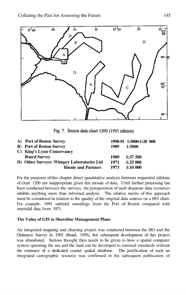
A) Port of Boston Survey
B) Port of Boston Survey
C) King’s Lynn Conservancy
Board Survey
D) Other Surveys: Wimpey Laboratories Ltd
Binnie and Partners
1990-91 1:5000-1:20 000
1989
1:5000
1989 1:37 500
1971 1:25 000
1973 1:10 000
For the purposes of this chapter direct quantitative analysis between sequential editions
of chart 1200 are inappropriate given this mosaic of data. Until further processing has
been conducted between the surveys, the juxtaposition of such disparate data resources
inhibits anything more than informed analysis. The relative merits of this approach
must be considered in relation to the quality of the original data sources on a HO chart.
For example, 1991 subtidal soundings from the Port of Boston compared with
intertidal data from 1971.
The Value of GIS to Shoreline Management Plans
An integrated mapping and charting project was conducted between the HO and the
Ordnance Survey in 1992 (Bond, 1995), but subsequent development of this project
was abandoned. Serious thought then needs to be given to how a spatial computer
system spanning the sea and the land can be developed to national standards without
the existence of a dedicated coastal spatial database. The justification of such an
integrated cartographic resource was confirmed in the subsequent publication of
145
A) Port of Boston Survey
B) Port of Boston Survey
C) King’s Lynn Conservancy
Board Survey
D) Other Surveys: Wimpey Laboratories Ltd
Binnie and Partners
1990-91 1:5000-1:20 000
1989
1:5000
1989 1:37 500
1971 1:25 000
1973 1:10 000
For the purposes of this chapter direct quantitative analysis between sequential editions
of chart 1200 are inappropriate given this mosaic of data. Until further processing has
been conducted between the surveys, the juxtaposition of such disparate data resources
inhibits anything more than informed analysis. The relative merits of this approach
must be considered in relation to the quality of the original data sources on a HO chart.
For example, 1991 subtidal soundings from the Port of Boston compared with
intertidal data from 1971.
The Value of GIS to Shoreline Management Plans
An integrated mapping and charting project was conducted between the HO and the
Ordnance Survey in 1992 (Bond, 1995), but subsequent development of this project
was abandoned. Serious thought then needs to be given to how a spatial computer
system spanning the sea and the land can be developed to national standards without
the existence of a dedicated coastal spatial database. The justification of such an
integrated cartographic resource was confirmed in the subsequent publication of