

502
J.L. Probst et al.
!
o
20 km
L...' _
- - ' -_ - - - - ' ,
CD Thanl't
CD Vieux· ThdM 1
Q) Industrial Waste
water
@ Vieux -Thann 2
® Enslshelm
® VleHle · Thur rlvE'r
G) H[ river
® Reguishe im
+ ® Lauch river
@> Obe-rhergheim
® Ladhof
® Fecht river
@ IUhatussern
@ Giessen river
@ Huttenht"rm
® Ohnheim
o Quate rnary
I.,.. , VolcanIC massif
~ Cluster ot fa.ult
IITIIIIJ Mt"sozoic: covel'
B Hercynian basement
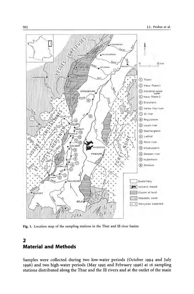
Fig. 1. Location map of the sampling stations in the Thur and III river basins
2
Material and Methods
Samples were collected during two low-water periods (October 1994 and July
1996) and two high-water periods (May 1995 and February 1996) at 16 sampling
stations distributed along the Ihur and the III rivers and at the outlet of the main
J.L. Probst et al.
!
o
20 km
L...' _
- - ' -_ - - - - ' ,
CD Thanl't
CD Vieux· ThdM 1
Q) Industrial Waste
water
@ Vieux -Thann 2
® Enslshelm
® VleHle · Thur rlvE'r
G) H[ river
® Reguishe im
+ ® Lauch river
@> Obe-rhergheim
® Ladhof
® Fecht river
@ IUhatussern
@ Giessen river
@ Huttenht"rm
® Ohnheim
o Quate rnary
I.,.. , VolcanIC massif
~ Cluster ot fa.ult
IITIIIIJ Mt"sozoic: covel'
B Hercynian basement
Fig. 1. Location map of the sampling stations in the Thur and III river basins
2
Material and Methods
Samples were collected during two low-water periods (October 1994 and July
1996) and two high-water periods (May 1995 and February 1996) at 16 sampling
stations distributed along the Ihur and the III rivers and at the outlet of the main