

Reef Mappi ng
85
oblique angles through spacecraft windows. When
feasible, near vertical photographs have been
rotated so that north is toward the top of the page.
An approximate scale bar and north arrow have
been added based on reference to a 1:1 000 000
scale navigation chart.
Astronaut photographs provide a unique
source of moderate resolution reet remote sensing
data. They provide global coverage, with free and
immediate availability in the public domain. The
database of photographs can be searched and
browsed online, and high resolution digital copies
of photographs in this atlas can be accessed via the
website of Earth Science and Image Analysis at
NASA's Johnson Space Center:
http://eoLjsc.nasa.gov
Julie A Robinson (Johnson Space Center! and Marco Noordeloos IReefBasel
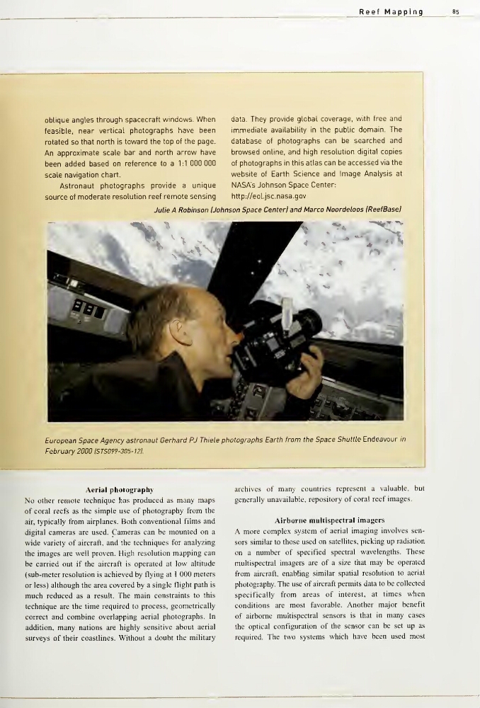
European Space Agency astronaut Gerhard PJ Thiele photographs Earth from the Space Shuttle Endeavour in
February 2000 ISTS099-305- 121.
Aerial photography
No other remote technique has produced as many maps
of coral reefs as the simple use of photography from the
air, typically from airplanes. Both conventional films and
digital cameras are used. Cameras can be mounted on a
wide variety of aircraft, and the techniques for analyzing
the images are well proven. High resolution mapping can
be carried out if the aircraft is operated at low altitude
(sub-meter resolution is achieved by flying at 1 000 meters
or less) although the area covered by a single flight path is
much reduced as a result. The main constraints to this
technique are the time required to process, geometrically
correct and combine overlapping aerial photographs. In
addition, many nations are highly sensitive about aerial
surveys of their coastlines. Without a doubt the military
archives of many countries represent a valuable, but
generally unavailable, repository of coral reef images.
Airborne multispectral imagers
A more complex system of aerial imaging involves sensors similar to those used on satellites, pickmg up radiation
on a number of specified spectral wavelengths. These
multispectral imagers are of a size that may be operated
from aircraft, enabling similar spatial resolution to aerial
photography. The use of aircraft permits data to be collected
specifically from areas of interest, at times when
conditions are most favorable. Another major benefit
of airborne multispectral sensors is that in many cases
the optical configuration of the sensor can be set up as
required. The two systems which have been used most
85
oblique angles through spacecraft windows. When
feasible, near vertical photographs have been
rotated so that north is toward the top of the page.
An approximate scale bar and north arrow have
been added based on reference to a 1:1 000 000
scale navigation chart.
Astronaut photographs provide a unique
source of moderate resolution reet remote sensing
data. They provide global coverage, with free and
immediate availability in the public domain. The
database of photographs can be searched and
browsed online, and high resolution digital copies
of photographs in this atlas can be accessed via the
website of Earth Science and Image Analysis at
NASA's Johnson Space Center:
http://eoLjsc.nasa.gov
Julie A Robinson (Johnson Space Center! and Marco Noordeloos IReefBasel
European Space Agency astronaut Gerhard PJ Thiele photographs Earth from the Space Shuttle Endeavour in
February 2000 ISTS099-305- 121.
Aerial photography
No other remote technique has produced as many maps
of coral reefs as the simple use of photography from the
air, typically from airplanes. Both conventional films and
digital cameras are used. Cameras can be mounted on a
wide variety of aircraft, and the techniques for analyzing
the images are well proven. High resolution mapping can
be carried out if the aircraft is operated at low altitude
(sub-meter resolution is achieved by flying at 1 000 meters
or less) although the area covered by a single flight path is
much reduced as a result. The main constraints to this
technique are the time required to process, geometrically
correct and combine overlapping aerial photographs. In
addition, many nations are highly sensitive about aerial
surveys of their coastlines. Without a doubt the military
archives of many countries represent a valuable, but
generally unavailable, repository of coral reef images.
Airborne multispectral imagers
A more complex system of aerial imaging involves sensors similar to those used on satellites, pickmg up radiation
on a number of specified spectral wavelengths. These
multispectral imagers are of a size that may be operated
from aircraft, enabling similar spatial resolution to aerial
photography. The use of aircraft permits data to be collected
specifically from areas of interest, at times when
conditions are most favorable. Another major benefit
of airborne multispectral sensors is that in many cases
the optical configuration of the sensor can be set up as
required. The two systems which have been used most