

Southeast Asia
261
Thailand, Myanmar and
Cambodia
MAP 10a
ThSllSnd
is a large country lying in the center
of mainland Southeast Asia and extending far south
along the Malay Peninsula towards the Malaysian
border. The coastline is clearly divided into those sections
which border the Gulf of Thailand and a shorter coastline
on the Andaman Sea. The Gulf of Thailand is a shallow
semi-enclosed sea, generally less than 60 meters in depth.
It is heavily sedimented, particularly in the north and west,
but highly productive. The tidal systems are diurnal, while
monsoonal weather exerts the predominant influence on
reef development. In the northeast much of the coast is
affected by riverine runoff and there are some large
mangrove communities, but fringing reefs have developed
away from riverine inputs, and there are quite a number
of islands with important fringing reef communities
offshore. In the northwest the coastline is indented into the
Bight of Bangkok where there is massive riverine input
from four major rivers and large reef structures do not
occur, although coral communities are reported in a few
places, particularly around the offshore islands. More
reefs occur on the eastern shores of Thailand (the western
shores of the gulf). These are largely around offshore
islands, with limited developments around the islands of
Prachuab Kirikhan and more extensive ones around the
western shores of the islands of Chumphon and on all
sides of the islands near Sural Thani. In all areas the
relatively harsh physical conditions have restricted reef
diversity, and coral numbers in the Gulf of Thailand are
far lower than in surrounding regions.
The coastline facing the Andaman Sea is somewhat
different. The continental shelf lies about 200 kilometers
offshore in the south, although only some 50 kilometers
offshore around Phuket. This coastline is heavily affected
by the contrasting influences of the strong Southwest
Monsoon (May-October) driving onshore winds and
rough conditions, while during the Northeast Monsoon
(November-April) conditions are generally very calm.
This coastline has the largest areas of mangroves in
Thailand, and there are also extensive coral reefs,
particularly along the shores of the numerous offshore
islands. The degree of reef development appears to be
related to distance from shore and level of exposure.
Fringing communities are generally better developed on
the eastern coasts of the islands. Extensive reef structures
are reported from the Adang Rawi group in the south and
around the Surin Islands, a southerly extension of the
Mergui Archipelago. The majority of reef research in
this country has been focussed around Phuket and the
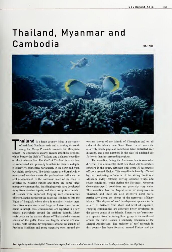
Two spot-naped butterflyfish Chaetodon oxycephalus on a shallow reef. This species feeds primarily on coral polyps.
261
Thailand, Myanmar and
Cambodia
MAP 10a
ThSllSnd
is a large country lying in the center
of mainland Southeast Asia and extending far south
along the Malay Peninsula towards the Malaysian
border. The coastline is clearly divided into those sections
which border the Gulf of Thailand and a shorter coastline
on the Andaman Sea. The Gulf of Thailand is a shallow
semi-enclosed sea, generally less than 60 meters in depth.
It is heavily sedimented, particularly in the north and west,
but highly productive. The tidal systems are diurnal, while
monsoonal weather exerts the predominant influence on
reef development. In the northeast much of the coast is
affected by riverine runoff and there are some large
mangrove communities, but fringing reefs have developed
away from riverine inputs, and there are quite a number
of islands with important fringing reef communities
offshore. In the northwest the coastline is indented into the
Bight of Bangkok where there is massive riverine input
from four major rivers and large reef structures do not
occur, although coral communities are reported in a few
places, particularly around the offshore islands. More
reefs occur on the eastern shores of Thailand (the western
shores of the gulf). These are largely around offshore
islands, with limited developments around the islands of
Prachuab Kirikhan and more extensive ones around the
western shores of the islands of Chumphon and on all
sides of the islands near Sural Thani. In all areas the
relatively harsh physical conditions have restricted reef
diversity, and coral numbers in the Gulf of Thailand are
far lower than in surrounding regions.
The coastline facing the Andaman Sea is somewhat
different. The continental shelf lies about 200 kilometers
offshore in the south, although only some 50 kilometers
offshore around Phuket. This coastline is heavily affected
by the contrasting influences of the strong Southwest
Monsoon (May-October) driving onshore winds and
rough conditions, while during the Northeast Monsoon
(November-April) conditions are generally very calm.
This coastline has the largest areas of mangroves in
Thailand, and there are also extensive coral reefs,
particularly along the shores of the numerous offshore
islands. The degree of reef development appears to be
related to distance from shore and level of exposure.
Fringing communities are generally better developed on
the eastern coasts of the islands. Extensive reef structures
are reported from the Adang Rawi group in the south and
around the Surin Islands, a southerly extension of the
Mergui Archipelago. The majority of reef research in
this country has been focussed around Phuket and the
Two spot-naped butterflyfish Chaetodon oxycephalus on a shallow reef. This species feeds primarily on coral polyps.