

244
WORLD ATLAS OF CORAL REEFS
Southern Red Sea: Eritrea
and Yemen
MAP9C
The
physical structure of the Red Sea changes significantly in its southern sections. Offshore, the
continental shelf broadens and waters remain
relatively shallow over wide areas, while the inshore waters
become somewhat turbid. Nearshore fringing reefs are less
common on the mainland coasts, although some are found
around offshore islands. Two major archipelagos are
located here: the Farasan Islands off the Saudi Arabian
coast which extend into the Kamaran Islands off Yemen,
and the Dahlak Archipelago off the coast of Eritrea. There
are also several small islands further to the south. The geological origin of these is complex. The Farasan and Dahlak
archipelagos and the Kamaran Islands are carbonate platforms which have been uplifted and undergone some further
modifications. Some of the islands further south are of
volcanic origin, and this is still a tectonically active region.
There are large areas of alga! reefs - calcareous platforms
built almost entirely from coralline red algae - with a
probable total area of several hundred square kilometers.
These have developed on the sandy sublittoral zones in
nearshore waters where conditions of temperature, salinity
and turbidity appear inimical to coral growth.
South of about 1 7°N the coasts of the Red Sea draw
together. At the mouth of the Red Sea, known as the Bab el
Mandeb (Gate of Lamentations), the water is only about
130 meters deep. Annual precipitation over the entire Red
Sea is about 10 millimeters, while evaporation removes
something of the order of 2 meters of water per year.
There is therefore a net inflow of water through the Bab el
Mandeb, although surface currents are more complex with
a reversed flow for part of the summer. There is also a deep
current of denser more saline water flowing outwards. The
water entering the Red Sea from the Gulf of Aden is
relatively rich in nutrients and plankton, contributing to the
turbidity which appears to restrict reef development in the
southern Red Sea.
Temperatures in the southern Red Sea are high, with
mean surface values of over 32°C recorded in Yemen, while
lagoon waters regularly reach 45°C. By contrast salinities in
this region are closer to those of the open ocean.
Biologically, the southern Red Sea is very distinct.
Mangroves are well developed along significant stretches
of the coastline, as are seagrasses in shallow nearshore
waters. In contrast, many of the fringing reefs are poorly
developed, and even around the offshore islands partial
coral cover or fragmentary reef development is common.
There are lower diversities of both fish and corals (and
presumably other faunal groups) on almost all reefs,
although there is also some species replacement of those
found further north. The changes and decreases in diversity
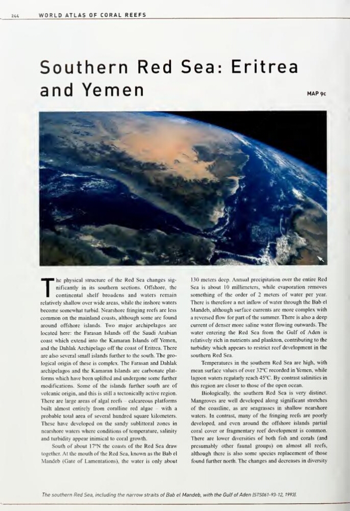
The southern Red Sea, including the narrow straits of Bab el Mandeb. with the Gulf of Aden ISTS061 -93-12. 1993].
WORLD ATLAS OF CORAL REEFS
Southern Red Sea: Eritrea
and Yemen
MAP9C
The
physical structure of the Red Sea changes significantly in its southern sections. Offshore, the
continental shelf broadens and waters remain
relatively shallow over wide areas, while the inshore waters
become somewhat turbid. Nearshore fringing reefs are less
common on the mainland coasts, although some are found
around offshore islands. Two major archipelagos are
located here: the Farasan Islands off the Saudi Arabian
coast which extend into the Kamaran Islands off Yemen,
and the Dahlak Archipelago off the coast of Eritrea. There
are also several small islands further to the south. The geological origin of these is complex. The Farasan and Dahlak
archipelagos and the Kamaran Islands are carbonate platforms which have been uplifted and undergone some further
modifications. Some of the islands further south are of
volcanic origin, and this is still a tectonically active region.
There are large areas of alga! reefs - calcareous platforms
built almost entirely from coralline red algae - with a
probable total area of several hundred square kilometers.
These have developed on the sandy sublittoral zones in
nearshore waters where conditions of temperature, salinity
and turbidity appear inimical to coral growth.
South of about 1 7°N the coasts of the Red Sea draw
together. At the mouth of the Red Sea, known as the Bab el
Mandeb (Gate of Lamentations), the water is only about
130 meters deep. Annual precipitation over the entire Red
Sea is about 10 millimeters, while evaporation removes
something of the order of 2 meters of water per year.
There is therefore a net inflow of water through the Bab el
Mandeb, although surface currents are more complex with
a reversed flow for part of the summer. There is also a deep
current of denser more saline water flowing outwards. The
water entering the Red Sea from the Gulf of Aden is
relatively rich in nutrients and plankton, contributing to the
turbidity which appears to restrict reef development in the
southern Red Sea.
Temperatures in the southern Red Sea are high, with
mean surface values of over 32°C recorded in Yemen, while
lagoon waters regularly reach 45°C. By contrast salinities in
this region are closer to those of the open ocean.
Biologically, the southern Red Sea is very distinct.
Mangroves are well developed along significant stretches
of the coastline, as are seagrasses in shallow nearshore
waters. In contrast, many of the fringing reefs are poorly
developed, and even around the offshore islands partial
coral cover or fragmentary reef development is common.
There are lower diversities of both fish and corals (and
presumably other faunal groups) on almost all reefs,
although there is also some species replacement of those
found further north. The changes and decreases in diversity
The southern Red Sea, including the narrow straits of Bab el Mandeb. with the Gulf of Aden ISTS061 -93-12. 1993].