

7.4.4 Results
In conclusion, we developed and applied a method to detect habitat types on
satellite images that produced results of a quality to be used in regional habitat
monitoring (see Fig. 7.5).
The resulting habitat map is 87 % accurate and can be processed further to determine
the conservation status of a habitat. Provided that the necessary input data and adequate
ground truth data for calibration and validation are available our approach can be
replicated in other Alpine areas and for different time periods. The output habitat map
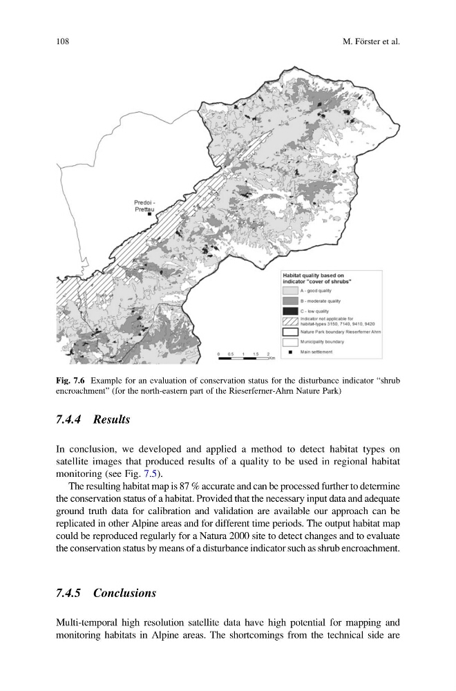
could be reproduced regularly for a Natura 2000 site to detect changes and to evaluate
the conservation status by means of a disturbance indicator such as shrub encroachment.
7.4.5 Conclusions
Multi-temporal high resolution satellite data have high potential for mapping and
monitoring habitats in Alpine areas. The shortcomings from the technical side are
Fig. 7.6 Example for an evaluation of conservation status for the disturbance indicator “shrub
encroachment” (for the north-eastern part of the Rieserferner-Ahrn Nature Park)
108
M. Fo ¨rster et al.
In conclusion, we developed and applied a method to detect habitat types on
satellite images that produced results of a quality to be used in regional habitat
monitoring (see Fig. 7.5).
The resulting habitat map is 87 % accurate and can be processed further to determine
the conservation status of a habitat. Provided that the necessary input data and adequate
ground truth data for calibration and validation are available our approach can be
replicated in other Alpine areas and for different time periods. The output habitat map
could be reproduced regularly for a Natura 2000 site to detect changes and to evaluate
the conservation status by means of a disturbance indicator such as shrub encroachment.
7.4.5 Conclusions
Multi-temporal high resolution satellite data have high potential for mapping and
monitoring habitats in Alpine areas. The shortcomings from the technical side are
Fig. 7.6 Example for an evaluation of conservation status for the disturbance indicator “shrub
encroachment” (for the north-eastern part of the Rieserferner-Ahrn Nature Park)
108
M. Fo ¨rster et al.