

The pre-processing of the images included geometric correction (image-to-image)
and radiometric normalisation to a cloud-free reference image in the middle of the
vegetation period with a high radiometric quality (RapidEye image from 26-08-2011)
to adjust the spectral variability. The IR-MAD algorithm implemented in ENVI/IDL
was used for the radiometric normalisation. This algorithm automatically detects
no-change pixels based on a no-change probability threshold and performs a relative
radiometric normalisation of the images (Canty and Nielsen 2008).
Since the spatial accuracy of additionally available forest inventory data was
insufficient to generate training samples for a supervised tree species classification,
an unsupervised Isodata classification was performed in order to allocate spectral
homogeneous clusters. These clusters were visually interpreted using aerial photographs and attributed to the classes beech, spruce, or open landscape. Subsequently,
for each class, 1,000 random sample points were generated based on these spectral
homogeneous areas. From these extracted sample points, a supervised classification,
based on multi-temporal data using the Support Vector Machine (SVM) algorithm
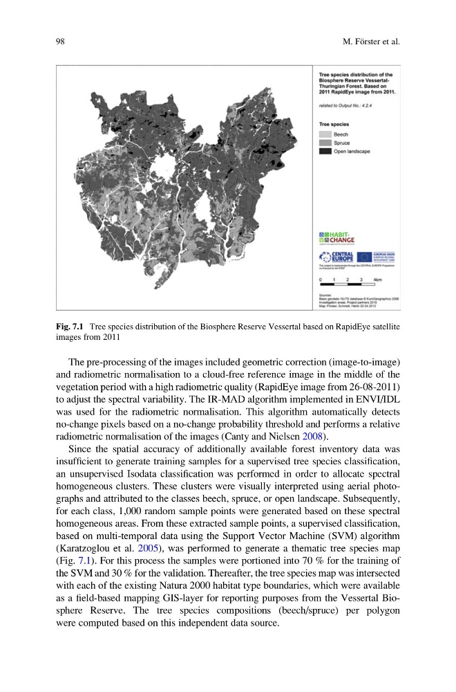
(Karatzoglou et al. 2005), was performed to generate a thematic tree species map
(Fig. 7.1). For this process the samples were portioned into 70 % for the training of
the SVM and 30 % for the validation. Thereafter, the tree species map was intersected
with each of the existing Natura 2000 habitat type boundaries, which were available
as a field-based mapping GIS-layer for reporting purposes from the Vessertal Biosphere Reserve. The tree species compositions (beech/spruce) per polygon
were computed based on this independent data source.
Fig. 7.1 Tree species distribution of the Biosphere Reserve Vessertal based on RapidEye satellite
images from 2011
98
M. Fo ¨rster et al.
and radiometric normalisation to a cloud-free reference image in the middle of the
vegetation period with a high radiometric quality (RapidEye image from 26-08-2011)
to adjust the spectral variability. The IR-MAD algorithm implemented in ENVI/IDL
was used for the radiometric normalisation. This algorithm automatically detects
no-change pixels based on a no-change probability threshold and performs a relative
radiometric normalisation of the images (Canty and Nielsen 2008).
Since the spatial accuracy of additionally available forest inventory data was
insufficient to generate training samples for a supervised tree species classification,
an unsupervised Isodata classification was performed in order to allocate spectral
homogeneous clusters. These clusters were visually interpreted using aerial photographs and attributed to the classes beech, spruce, or open landscape. Subsequently,
for each class, 1,000 random sample points were generated based on these spectral
homogeneous areas. From these extracted sample points, a supervised classification,
based on multi-temporal data using the Support Vector Machine (SVM) algorithm
(Karatzoglou et al. 2005), was performed to generate a thematic tree species map
(Fig. 7.1). For this process the samples were portioned into 70 % for the training of
the SVM and 30 % for the validation. Thereafter, the tree species map was intersected
with each of the existing Natura 2000 habitat type boundaries, which were available
as a field-based mapping GIS-layer for reporting purposes from the Vessertal Biosphere Reserve. The tree species compositions (beech/spruce) per polygon
were computed based on this independent data source.
Fig. 7.1 Tree species distribution of the Biosphere Reserve Vessertal based on RapidEye satellite
images from 2011
98
M. Fo ¨rster et al.