

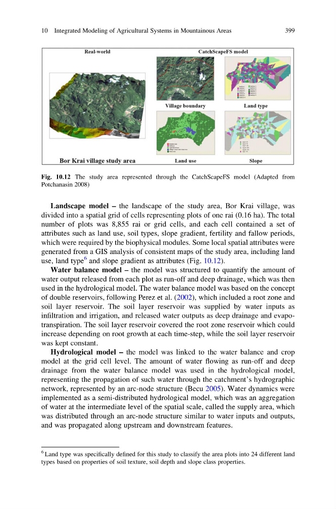
Landscape model – the landscape of the study area, Bor Krai village, was
divided into a spatial grid of cells representing plots of one rai (0.16 ha). The total
number of plots was 8,855 rai or grid cells, and each cell contained a set of
attributes such as land use, soil types, slope gradient, fertility and fallow periods,
which were required by the biophysical modules. Some local spatial attributes were
generated from a GIS analysis of consistent maps of the study area, including land
use, land type
6 and slope gradient as attributes (Fig. 10.12).
Water balance model – the model was structured to quantify the amount of
water output released from each plot as run-off and deep drainage, which was then
used in the hydrological model. The water balance model was based on the concept
of double reservoirs, following Perez et al. (2002), which included a root zone and
soil layer reservoir. The soil layer reservoir was supplied by water inputs as
infiltration and irrigation, and released water outputs as deep drainage and evapotranspiration. The soil layer reservoir covered the root zone reservoir which could
increase depending on root growth at each time-step, while the soil layer reservoir
was kept constant.
Hydrological model – the model was linked to the water balance and crop
model at the grid cell level. The amount of water flowing as run-off and deep
drainage from the water balance model was used in the hydrological model,
representing the propagation of such water through the catchment’s hydrographic
network, represented by an arc-node structure (Becu 2005). Water dynamics were
implemented as a semi-distributed hydrological model, which was an aggregation
of water at the intermediate level of the spatial scale, called the supply area, which
was distributed through an arc-node structure similar to water inputs and outputs,
and was propagated along upstream and downstream features.
Fig. 10.12 The study area represented through the CatchScapeFS model (Adapted from
Potchanasin 2008)
6 Land type was specifically defined for this study to classify the area plots into 24 different land
types based on properties of soil texture, soil depth and slope class properties.
10 Integrated Modeling of Agricultural Systems in Mountainous Areas
399
divided into a spatial grid of cells representing plots of one rai (0.16 ha). The total
number of plots was 8,855 rai or grid cells, and each cell contained a set of
attributes such as land use, soil types, slope gradient, fertility and fallow periods,
which were required by the biophysical modules. Some local spatial attributes were
generated from a GIS analysis of consistent maps of the study area, including land
use, land type
6 and slope gradient as attributes (Fig. 10.12).
Water balance model – the model was structured to quantify the amount of
water output released from each plot as run-off and deep drainage, which was then
used in the hydrological model. The water balance model was based on the concept
of double reservoirs, following Perez et al. (2002), which included a root zone and
soil layer reservoir. The soil layer reservoir was supplied by water inputs as
infiltration and irrigation, and released water outputs as deep drainage and evapotranspiration. The soil layer reservoir covered the root zone reservoir which could
increase depending on root growth at each time-step, while the soil layer reservoir
was kept constant.
Hydrological model – the model was linked to the water balance and crop
model at the grid cell level. The amount of water flowing as run-off and deep
drainage from the water balance model was used in the hydrological model,
representing the propagation of such water through the catchment’s hydrographic
network, represented by an arc-node structure (Becu 2005). Water dynamics were
implemented as a semi-distributed hydrological model, which was an aggregation
of water at the intermediate level of the spatial scale, called the supply area, which
was distributed through an arc-node structure similar to water inputs and outputs,
and was propagated along upstream and downstream features.
Fig. 10.12 The study area represented through the CatchScapeFS model (Adapted from
Potchanasin 2008)
6 Land type was specifically defined for this study to classify the area plots into 24 different land
types based on properties of soil texture, soil depth and slope class properties.
10 Integrated Modeling of Agricultural Systems in Mountainous Areas
399