

100
within the program. The fi nal outcome was presented as a report, presentation, and
a journal paper.
6.3.3 The Selection of a Study Area
Guangzhou is in southern China on the Pearl River Delta plain. The city of
Guangzhou has ten districts (Yuexiu, Dongshan, Haizhu, Liwan, Tianhe, Baiyun
Whampoa, Fangchun, Huadu and Panyu) with an area of approximately 3,718.8 km
2
(about 50% of the total municipal area) with a census population of 7.4 million
(74% of the total municipal population) [ 14 ]. Land use change from 2003 to 2008
in Guangzhou was analyzed using GIS to investigate how urbanization was taking
place over a decade.
Dramatic changes in the built-up area over 5 years were compared with other land
use, such as water bodies, arable land, transportation, and forests, as illustrated in
Fig. 6.4 . The built-up area in 2003 is in orange (agglomerated in central Guangzhou);
the area in black shows not only the old town but also all over the city as a new town
in 2008. It was very clear that the city underwent signifi cant change in land use
between 2003 and 2008 due to rapid urbanization. Among the major changes, the
most prominent was the increase in built-up area (about 80% compared with data
from 2003). On the other hand, as shown in Fig. 6.5 , water bodies and arable land
were not conserved but were taken over by built-up areas.
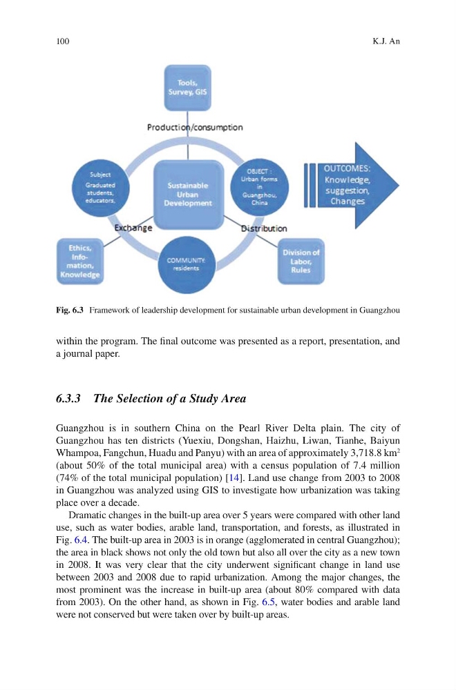
Fig. 6.3 Framework of leadership development for sustainable urban development in Guangzhou
K.J. An
within the program. The fi nal outcome was presented as a report, presentation, and
a journal paper.
6.3.3 The Selection of a Study Area
Guangzhou is in southern China on the Pearl River Delta plain. The city of
Guangzhou has ten districts (Yuexiu, Dongshan, Haizhu, Liwan, Tianhe, Baiyun
Whampoa, Fangchun, Huadu and Panyu) with an area of approximately 3,718.8 km
2
(about 50% of the total municipal area) with a census population of 7.4 million
(74% of the total municipal population) [ 14 ]. Land use change from 2003 to 2008
in Guangzhou was analyzed using GIS to investigate how urbanization was taking
place over a decade.
Dramatic changes in the built-up area over 5 years were compared with other land
use, such as water bodies, arable land, transportation, and forests, as illustrated in
Fig. 6.4 . The built-up area in 2003 is in orange (agglomerated in central Guangzhou);
the area in black shows not only the old town but also all over the city as a new town
in 2008. It was very clear that the city underwent signifi cant change in land use
between 2003 and 2008 due to rapid urbanization. Among the major changes, the
most prominent was the increase in built-up area (about 80% compared with data
from 2003). On the other hand, as shown in Fig. 6.5 , water bodies and arable land
were not conserved but were taken over by built-up areas.
Fig. 6.3 Framework of leadership development for sustainable urban development in Guangzhou
K.J. An