

experiments was supplied by the Laboratory for Atmospheric and Space Physics
(LASP) of the University of Colorado Boulder and launched from Fort Sumner,
NM on September 29, 2013 and again on August 18, 2014 using a ZPB with the
NASA/WFF WASP.
The intent of HySICS was to demonstrate radiometric accuracies better than
0.2% in the short wave spectral region (350-2,300 nanometers) at resolutions of
better than 8 nanometers. This was identified as necessary for Earth climate science by the Decadal Survey “Earth Science and Applications from Space” issued
in 2007. The instrument displays scenes on a single focal plane array that spans
this solar and near-infrared spectral region, which spans most of the energy coming from the Sun. Using a single array allows HySICS to be smaller and lighter
than other spatial/spectral imager designs, enabling cost, mass, volume, and power
savings.
The high quality radiance measurements from the second HySICS flight, which
lasted almost 9 hours, were the most accurate ever achieved. As a bonus, it was
able to observe the Moon and provided improved radiance measurements of the
object that is commonly used for on-orbit calibrations of other instruments.
The HySICS data is helping to demonstrate the ability to obtain the radiometric
accuracy levels that are required for climate science using the Sun as an on-orbit
radiometric reference. Operating at close to 37 km (120,000 ft) the instrument is
demonstrating a solar cross-calibration approach and acquiring sample Earth and
lunar radiances in an effort to improve climate change models.
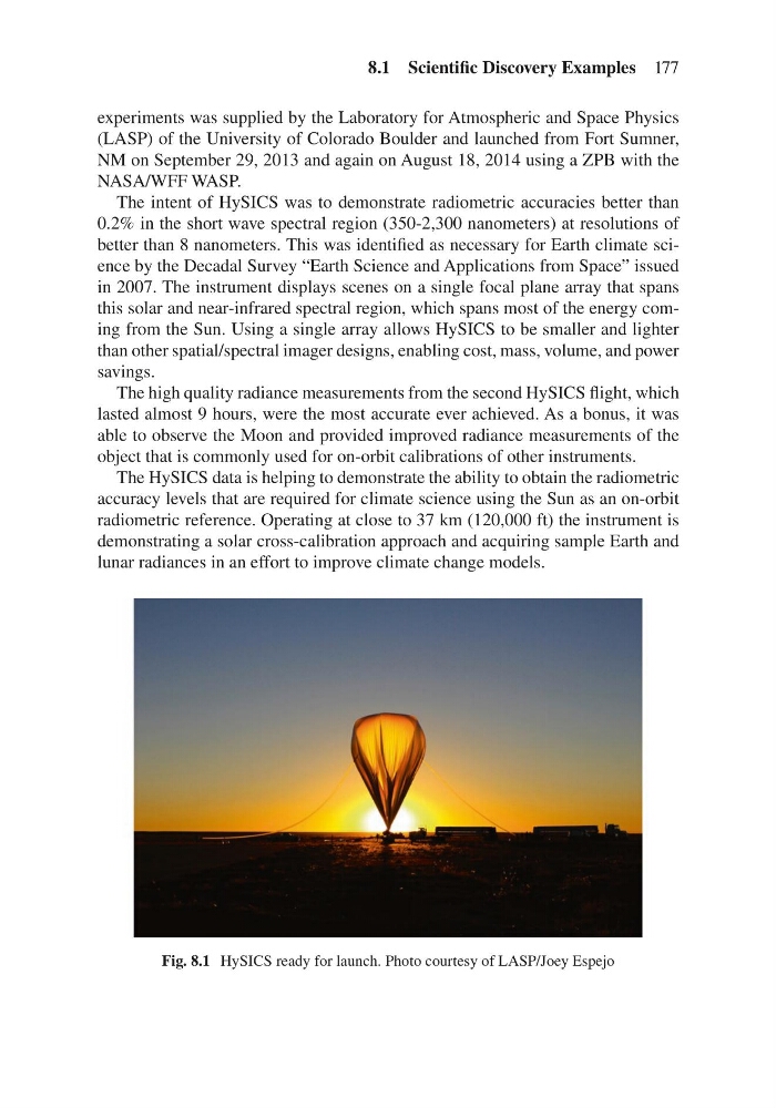
Fig. 8.1 HySICS ready for launch. Photo courtesy of LASP/Joey Espejo
8.1 Scientific Discovery Examples 177
(LASP) of the University of Colorado Boulder and launched from Fort Sumner,
NM on September 29, 2013 and again on August 18, 2014 using a ZPB with the
NASA/WFF WASP.
The intent of HySICS was to demonstrate radiometric accuracies better than
0.2% in the short wave spectral region (350-2,300 nanometers) at resolutions of
better than 8 nanometers. This was identified as necessary for Earth climate science by the Decadal Survey “Earth Science and Applications from Space” issued
in 2007. The instrument displays scenes on a single focal plane array that spans
this solar and near-infrared spectral region, which spans most of the energy coming from the Sun. Using a single array allows HySICS to be smaller and lighter
than other spatial/spectral imager designs, enabling cost, mass, volume, and power
savings.
The high quality radiance measurements from the second HySICS flight, which
lasted almost 9 hours, were the most accurate ever achieved. As a bonus, it was
able to observe the Moon and provided improved radiance measurements of the
object that is commonly used for on-orbit calibrations of other instruments.
The HySICS data is helping to demonstrate the ability to obtain the radiometric
accuracy levels that are required for climate science using the Sun as an on-orbit
radiometric reference. Operating at close to 37 km (120,000 ft) the instrument is
demonstrating a solar cross-calibration approach and acquiring sample Earth and
lunar radiances in an effort to improve climate change models.
Fig. 8.1 HySICS ready for launch. Photo courtesy of LASP/Joey Espejo
8.1 Scientific Discovery Examples 177