

82
from an urban planning perspective. In 1968 when urban sprawl was accelerating,
the City Planning Act was amended to initiate and area division system. Under this
system, a local municipality can divide an urban planning area into two areas: UPA
(Urbanization Promotion Area) and UCA (Urbanization Control Area) (Nakai
1988) (Fig. 4.30). UPA is the area where urbanization is promoted and aims to be
developed within 10 years. Once farmland or forest is included into UPA, the land
is regarded as potential land for future development.
Expectations of future development lead to drive land prices up significantly
which leads to easier conversion of farmland or forest to housing or other urban
land uses. UCA, on the contrary, is an area where urbanization is regulated and
which aims at conserving rural settings and agricultural activities. Land prices in
UCA are considerably lower compared to those of UPA because of land use regulations concerning future development. The top-right illustration of Fig. 4.30 shows
the actual implementation of area division system to the urban fringe of Funabashi.
Because the separation looks like a line drawn between UPA and UCA-commonly
called “senbiki” in Japanese, which literally means “draw a line”. Even the shape
of the line is not simple: the line makes a sharp contrast between UPA and UCA in
terms of building density or farmland ratio, for example.
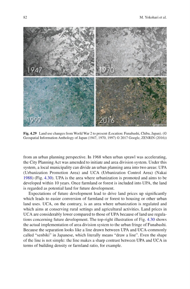
Fig. 4.29 Land use changes from World War 2 to present (Location: Funabashi, Chiba, Japan). (©
Geospatial Information Anthology of Japan (1947, 1970, 1997) © 2017 Google, ZENRIN (2016))
M. Yokohari et al.
from an urban planning perspective. In 1968 when urban sprawl was accelerating,
the City Planning Act was amended to initiate and area division system. Under this
system, a local municipality can divide an urban planning area into two areas: UPA
(Urbanization Promotion Area) and UCA (Urbanization Control Area) (Nakai
1988) (Fig. 4.30). UPA is the area where urbanization is promoted and aims to be
developed within 10 years. Once farmland or forest is included into UPA, the land
is regarded as potential land for future development.
Expectations of future development lead to drive land prices up significantly
which leads to easier conversion of farmland or forest to housing or other urban
land uses. UCA, on the contrary, is an area where urbanization is regulated and
which aims at conserving rural settings and agricultural activities. Land prices in
UCA are considerably lower compared to those of UPA because of land use regulations concerning future development. The top-right illustration of Fig. 4.30 shows
the actual implementation of area division system to the urban fringe of Funabashi.
Because the separation looks like a line drawn between UPA and UCA-commonly
called “senbiki” in Japanese, which literally means “draw a line”. Even the shape
of the line is not simple: the line makes a sharp contrast between UPA and UCA in
terms of building density or farmland ratio, for example.
Fig. 4.29 Land use changes from World War 2 to present (Location: Funabashi, Chiba, Japan). (©
Geospatial Information Anthology of Japan (1947, 1970, 1997) © 2017 Google, ZENRIN (2016))
M. Yokohari et al.