

degree of human influence, but the distance between occupied cliffs was reduced
(from 11.1 to 8.9 km). As a result, the probabilities of occupation predicted by the
model were lower for newly colonised sites. Interestingly, the cliffs located in
peripheral zones, without no previous bearded vulture territories, tended to be
smaller (mean height) and were usually located in less steep and lower altitude
zones. Also, they were closer in both, distance and altitude, to roads and they had a
greater neighbouring human population. The new territories occupied from 1991 to
2002 showed similar habitat characteristics to those occupied before 1991. The only
exception was the variable “nearest neighbour” distance. New territories were situated at a significantly smaller distance to other occupied territories than they were
before. In relation to randomly selected cliffs, new nest sites were in areas that were
more rugged, and in cliffs that were higher than average. In addition, new nesting
cliffs were not significantly further from the nearest occupied nest (mean: 8.9 km)
than random cliffs (mean: 8.1 km) with similar when comparing old nests to randomly selected cliffs.
The application of models including the variable “nearest neighbour” determined
that newly occupied cliffs had intermediate probability values between old nesting
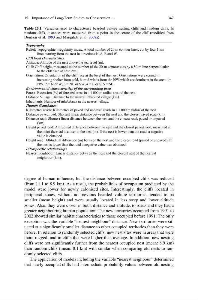
Table 15.1 Variables used to characterise bearded vulture nesting cliffs and random cliffs. In
random cliffs, distances were measured from a point in the centre of the cliff (modified from
Donázar et al. 1993 and Margalida et al. 2008a)
Topography
Relief: Topographic irregularity index. A total number of 20 m contour lines, cut by four 1 km
lines starting from the nest in directions N, S, E and W.
Cliff local characteristics
Altitude: Altitude of the nest above the sea-level (m).
Cliff: Cliff height, measured as the number of the 20-m contour cuts by a 50-m line perpendicular
to the cliff face at nest level.
Orientation: Orientation of the cliff face at the level of the nest. Orientations were scored in
increasing shelter from cold, humid winds from the NW which are dominant in the area: 1=
NW, 2 = N or W, 3 = NE or SW, 4 = E or S, 5 = SE.
Environmental characteristics of the surrounding area
Forest: Extension (%) of forested areas in a 1 000 m radius around the nest.
Distance Village: Distance to the nearest inhabited village (km).
Inhabitants: Number of inhabitants in the nearest village.
Human disturbance
Kilometres roads: Kilometres of paved and unpaved roads in a 1 000 m radius of the nest.
Distance paved road: Shortest linear distance between the nest and the closest paved road (km).
Distance road: Shortest linear distance between the nest and the closest road, paved or unpaved
(km).
Height paved road: Altitudinal difference between the nest and the closest paved road, measured at
the point the road is closer to the nest (m). If the nest is lower than the road, a negative
value is obtained.
Height road: Altitudinal difference (m) between the nest and the closest road (paved or unpaved). If
the nest is lower than the road a negative value was obtained.
Intraspecific relationships
Nearest neighbour: Linear distance between the nest and the closest nest of the nearest
neighbour (km).
15 Importance of Long-Term Studies to Conservation …
347
(from 11.1 to 8.9 km). As a result, the probabilities of occupation predicted by the
model were lower for newly colonised sites. Interestingly, the cliffs located in
peripheral zones, without no previous bearded vulture territories, tended to be
smaller (mean height) and were usually located in less steep and lower altitude
zones. Also, they were closer in both, distance and altitude, to roads and they had a
greater neighbouring human population. The new territories occupied from 1991 to
2002 showed similar habitat characteristics to those occupied before 1991. The only
exception was the variable “nearest neighbour” distance. New territories were situated at a significantly smaller distance to other occupied territories than they were
before. In relation to randomly selected cliffs, new nest sites were in areas that were
more rugged, and in cliffs that were higher than average. In addition, new nesting
cliffs were not significantly further from the nearest occupied nest (mean: 8.9 km)
than random cliffs (mean: 8.1 km) with similar when comparing old nests to randomly selected cliffs.
The application of models including the variable “nearest neighbour” determined
that newly occupied cliffs had intermediate probability values between old nesting
Table 15.1 Variables used to characterise bearded vulture nesting cliffs and random cliffs. In
random cliffs, distances were measured from a point in the centre of the cliff (modified from
Donázar et al. 1993 and Margalida et al. 2008a)
Topography
Relief: Topographic irregularity index. A total number of 20 m contour lines, cut by four 1 km
lines starting from the nest in directions N, S, E and W.
Cliff local characteristics
Altitude: Altitude of the nest above the sea-level (m).
Cliff: Cliff height, measured as the number of the 20-m contour cuts by a 50-m line perpendicular
to the cliff face at nest level.
Orientation: Orientation of the cliff face at the level of the nest. Orientations were scored in
increasing shelter from cold, humid winds from the NW which are dominant in the area: 1=
NW, 2 = N or W, 3 = NE or SW, 4 = E or S, 5 = SE.
Environmental characteristics of the surrounding area
Forest: Extension (%) of forested areas in a 1 000 m radius around the nest.
Distance Village: Distance to the nearest inhabited village (km).
Inhabitants: Number of inhabitants in the nearest village.
Human disturbance
Kilometres roads: Kilometres of paved and unpaved roads in a 1 000 m radius of the nest.
Distance paved road: Shortest linear distance between the nest and the closest paved road (km).
Distance road: Shortest linear distance between the nest and the closest road, paved or unpaved
(km).
Height paved road: Altitudinal difference between the nest and the closest paved road, measured at
the point the road is closer to the nest (m). If the nest is lower than the road, a negative
value is obtained.
Height road: Altitudinal difference (m) between the nest and the closest road (paved or unpaved). If
the nest is lower than the road a negative value was obtained.
Intraspecific relationships
Nearest neighbour: Linear distance between the nest and the closest nest of the nearest
neighbour (km).
15 Importance of Long-Term Studies to Conservation …
347