

14.4 Functional Supplement to Global Satellite Radio Navigation Systems
271
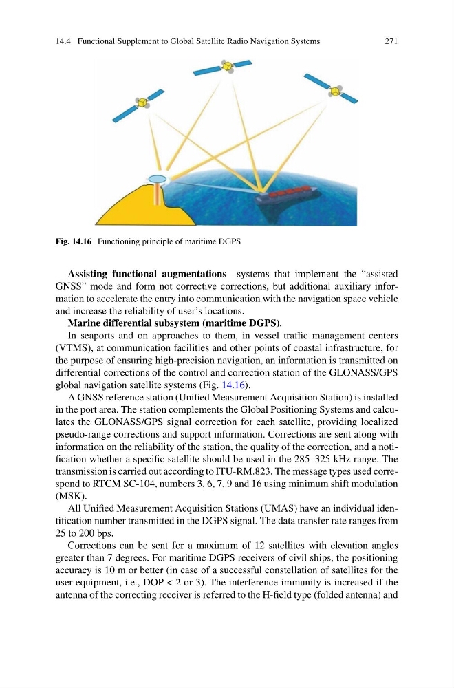
Fig. 14.16 Functioning principle of maritime DGPS
Assisting functional augmentations—systems that implement the “assisted
GNSS” mode and form not corrective corrections, but additional auxiliary information to accelerate the entry into communication with the navigation space vehicle
and increase the reliability of user’s locations.
Marine differential subsystem (maritime DGPS).
In seaports and on approaches to them, in vessel traffic management centers
(VTMS), at communication facilities and other points of coastal infrastructure, for
the purpose of ensuring high-precision navigation, an information is transmitted on
differential corrections of the control and correction station of the GLONASS/GPS
global navigation satellite systems (Fig. 14.16).
A GNSS reference station (Unified Measurement Acquisition Station) is installed
in the port area. The station complements the Global Positioning Systems and calculates the GLONASS/GPS signal correction for each satellite, providing localized
pseudo-range corrections and support information. Corrections are sent along with
information on the reliability of the station, the quality of the correction, and a notification whether a specific satellite should be used in the 285–325 kHz range. The
transmission is carried out according to ITU-RM.823. The message types used correspond to RTCM SC-104, numbers 3, 6, 7, 9 and 16 using minimum shift modulation
(MSK).
All Unified Measurement Acquisition Stations (UMAS) have an individual identification number transmitted in the DGPS signal. The data transfer rate ranges from
25 to 200 bps.
Corrections can be sent for a maximum of 12 satellites with elevation angles
greater than 7 degrees. For maritime DGPS receivers of civil ships, the positioning
accuracy is 10 m or better (in case of a successful constellation of satellites for the
user equipment, i.e., DOP < 2 or 3). The interference immunity is increased if the
antenna of the correcting receiver is referred to the H-field type (folded antenna) and
271
Fig. 14.16 Functioning principle of maritime DGPS
Assisting functional augmentations—systems that implement the “assisted
GNSS” mode and form not corrective corrections, but additional auxiliary information to accelerate the entry into communication with the navigation space vehicle
and increase the reliability of user’s locations.
Marine differential subsystem (maritime DGPS).
In seaports and on approaches to them, in vessel traffic management centers
(VTMS), at communication facilities and other points of coastal infrastructure, for
the purpose of ensuring high-precision navigation, an information is transmitted on
differential corrections of the control and correction station of the GLONASS/GPS
global navigation satellite systems (Fig. 14.16).
A GNSS reference station (Unified Measurement Acquisition Station) is installed
in the port area. The station complements the Global Positioning Systems and calculates the GLONASS/GPS signal correction for each satellite, providing localized
pseudo-range corrections and support information. Corrections are sent along with
information on the reliability of the station, the quality of the correction, and a notification whether a specific satellite should be used in the 285–325 kHz range. The
transmission is carried out according to ITU-RM.823. The message types used correspond to RTCM SC-104, numbers 3, 6, 7, 9 and 16 using minimum shift modulation
(MSK).
All Unified Measurement Acquisition Stations (UMAS) have an individual identification number transmitted in the DGPS signal. The data transfer rate ranges from
25 to 200 bps.
Corrections can be sent for a maximum of 12 satellites with elevation angles
greater than 7 degrees. For maritime DGPS receivers of civil ships, the positioning
accuracy is 10 m or better (in case of a successful constellation of satellites for the
user equipment, i.e., DOP < 2 or 3). The interference immunity is increased if the
antenna of the correcting receiver is referred to the H-field type (folded antenna) and