

3 Unmanned Aerial Vehicles for Environmental Monitoring …
35
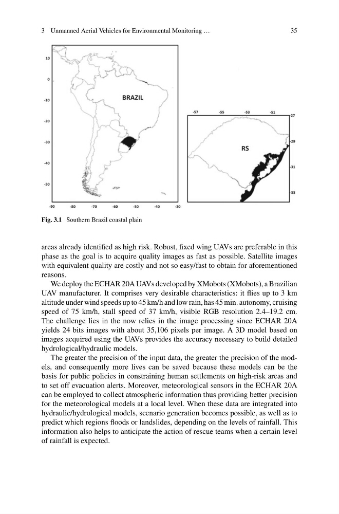
Fig. 3.1 Southern Brazil coastal plain
areas already identified as high risk. Robust, fixed wing UAVs are preferable in this
phase as the goal is to acquire quality images as fast as possible. Satellite images
with equivalent quality are costly and not so easy/fast to obtain for aforementioned
reasons.
We deploy the ECHAR 20A UAVs developed by XMobots (XMobots), a Brazilian
UAV manufacturer. It comprises very desirable characteristics: it flies up to 3 km
altitude under wind speeds up to 45 km/h and low rain, has 45 min. autonomy, cruising
speed of 75 km/h, stall speed of 37 km/h, visible RGB resolution 2.4–19.2 cm.
The challenge lies in the now relies in the image processing since ECHAR 20A
yields 24 bits images with about 35,106 pixels per image. A 3D model based on
images acquired using the UAVs provides the accuracy necessary to build detailed
hydrological/hydraulic models.
The greater the precision of the input data, the greater the precision of the models, and consequently more lives can be saved because these models can be the
basis for public policies in constraining human settlements on high-risk areas and
to set off evacuation alerts. Moreover, meteorological sensors in the ECHAR 20A
can be employed to collect atmospheric information thus providing better precision
for the meteorological models at a local level. When these data are integrated into
hydraulic/hydrological models, scenario generation becomes possible, as well as to
predict which regions floods or landslides, depending on the levels of rainfall. This
information also helps to anticipate the action of rescue teams when a certain level
of rainfall is expected.
35
Fig. 3.1 Southern Brazil coastal plain
areas already identified as high risk. Robust, fixed wing UAVs are preferable in this
phase as the goal is to acquire quality images as fast as possible. Satellite images
with equivalent quality are costly and not so easy/fast to obtain for aforementioned
reasons.
We deploy the ECHAR 20A UAVs developed by XMobots (XMobots), a Brazilian
UAV manufacturer. It comprises very desirable characteristics: it flies up to 3 km
altitude under wind speeds up to 45 km/h and low rain, has 45 min. autonomy, cruising
speed of 75 km/h, stall speed of 37 km/h, visible RGB resolution 2.4–19.2 cm.
The challenge lies in the now relies in the image processing since ECHAR 20A
yields 24 bits images with about 35,106 pixels per image. A 3D model based on
images acquired using the UAVs provides the accuracy necessary to build detailed
hydrological/hydraulic models.
The greater the precision of the input data, the greater the precision of the models, and consequently more lives can be saved because these models can be the
basis for public policies in constraining human settlements on high-risk areas and
to set off evacuation alerts. Moreover, meteorological sensors in the ECHAR 20A
can be employed to collect atmospheric information thus providing better precision
for the meteorological models at a local level. When these data are integrated into
hydraulic/hydrological models, scenario generation becomes possible, as well as to
predict which regions floods or landslides, depending on the levels of rainfall. This
information also helps to anticipate the action of rescue teams when a certain level
of rainfall is expected.