

48
sensors HICO (Hyperspectral Imager for the Coastal Ocean)
or the future HSI (Hyperspectral Imager) onboard EnMAP
(The Environmental Mapping and Analysis Program) are
hyperspectral sensors exhibiting measurement bands every
5–10 nm, which enables us to investigate even narrow spectral features (e.g., the phytoplankton peak near 683 nm).
Measurement
The satellites operate at a height where the atmosphere is
already extremely thin and, therefore, negligible. Hence,
we distinguish between at-sensor-measurements at top of
the atmosphere (TOA) and bottom of atmosphere (BOA)
measurements which are back-calculated from the TOA
measurements. The TOA measurement signal contains
information about the atmosphere and the underlying water
body or land surface. Depending on the atmospheric composition (gas mixtures, aerosols, clouds), the intensity
reduces by absorption and scattering in the incident direction. It can also increase if diffuse sky light scatters in the
direction of the incoming solar radiation.
At the water surface, the incident radiation is partly
reflected in the atmosphere and the other part penetrates the
water. Depending on the water conditions defined by the
water properties and the constituents, most of the radiation is
absorbed or scattered. A little part is scattered backwards and
leaves the water again. The amount of water-leaving photons
depends on the atmospheric and water conditions and the
radiation has to pass the atmosphere again to approach at the
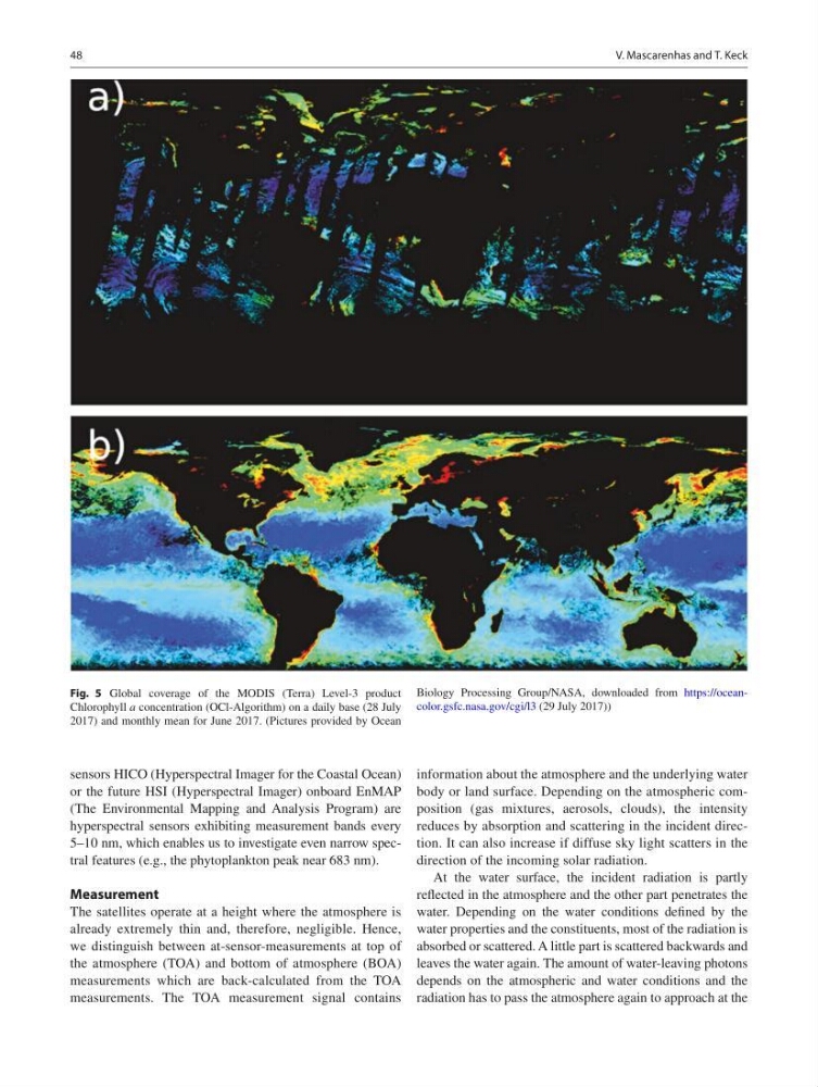
Fig. 5 Global coverage of the MODIS (Terra) Level-3 product
Chlorophyll a concentration (OCl-Algorithm) on a daily base (28 July
2017) and monthly mean for June 2017. (Pictures provided by Ocean
Biology Processing Group/NASA, downloaded from https://oceancolor.gsfc.nasa.gov/cgi/l3 (29 July 2017))
V. Mascarenhas and T. Keck
sensors HICO (Hyperspectral Imager for the Coastal Ocean)
or the future HSI (Hyperspectral Imager) onboard EnMAP
(The Environmental Mapping and Analysis Program) are
hyperspectral sensors exhibiting measurement bands every
5–10 nm, which enables us to investigate even narrow spectral features (e.g., the phytoplankton peak near 683 nm).
Measurement
The satellites operate at a height where the atmosphere is
already extremely thin and, therefore, negligible. Hence,
we distinguish between at-sensor-measurements at top of
the atmosphere (TOA) and bottom of atmosphere (BOA)
measurements which are back-calculated from the TOA
measurements. The TOA measurement signal contains
information about the atmosphere and the underlying water
body or land surface. Depending on the atmospheric composition (gas mixtures, aerosols, clouds), the intensity
reduces by absorption and scattering in the incident direction. It can also increase if diffuse sky light scatters in the
direction of the incoming solar radiation.
At the water surface, the incident radiation is partly
reflected in the atmosphere and the other part penetrates the
water. Depending on the water conditions defined by the
water properties and the constituents, most of the radiation is
absorbed or scattered. A little part is scattered backwards and
leaves the water again. The amount of water-leaving photons
depends on the atmospheric and water conditions and the
radiation has to pass the atmosphere again to approach at the
Fig. 5 Global coverage of the MODIS (Terra) Level-3 product
Chlorophyll a concentration (OCl-Algorithm) on a daily base (28 July
2017) and monthly mean for June 2017. (Pictures provided by Ocean
Biology Processing Group/NASA, downloaded from https://oceancolor.gsfc.nasa.gov/cgi/l3 (29 July 2017))
V. Mascarenhas and T. Keck