

391
The method used for modelling of transport of chemical substances required
to include a large territory in which boundary conditions were modelled, influencing meteorological quantities and concentrations of pollutants within the area
of interest. The entire modelled area covered Europe, i.e. area measuring 4
644 × 3 294 km with its centre being located in Prague. Assessment with the finest resolution was carried out for Prague and its surroundings where grids of
1 km and 333 m were used.
Input data for the project were prepared in such detail that has not yet been realized. For this purpose, data from regularly updated study Evaluation of Air Quality
in the Territory of the Capital City of Prague Based on Mathematical Modelling as
well as data about the area of interest provided by the IPR institute and available
databases from other sources were utilized.
The project involved both modelling of meteorological fields using the WRF
model and modelling of air pollutant dispersion using the CMAQ model. The meteorological model was con Fig.d with an urban surface impact model; the emission
flux model contained an anthropogenic emission model, a biogenic emission model,
a chemical transport model and modules of data post processing and statistical processing of the outputs. For long term experiments, urbanized RegCM was used with
10 km resolution, allowing SUBBATS (Pal, J. S., F. Giorgi, X. Bi, N. Elguindi,
F. Solomon, X. Gao, R. Francisco, A. Zakey, J. Winter, M. Ashfaq, F. Syed, J. L.
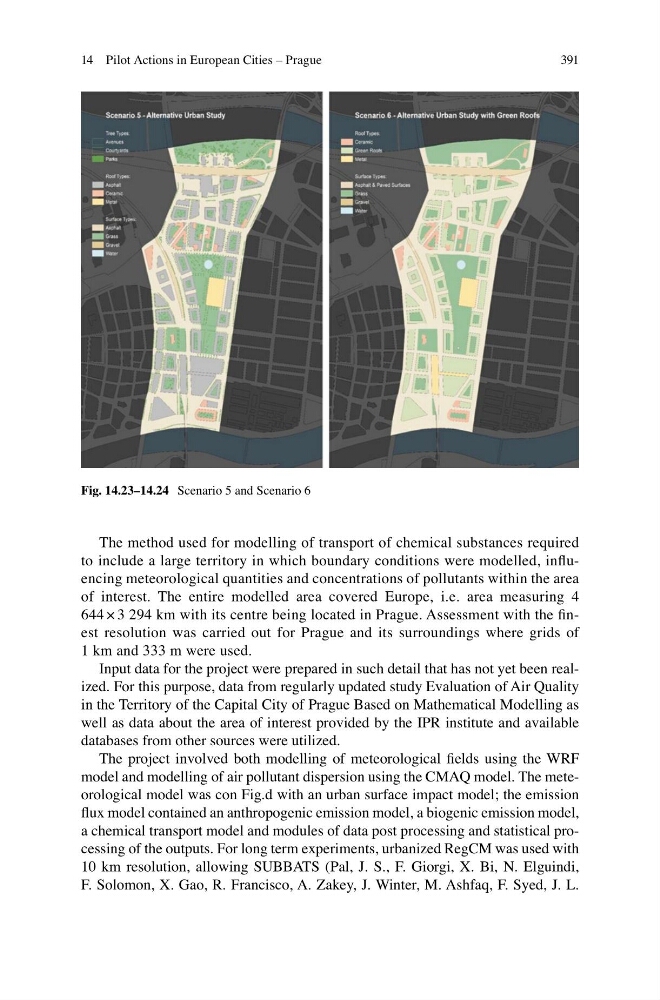
Fig. 14.23–14.24 Scenario 5 and Scenario 6
14 Pilot Actions in European Cities – Prague
The method used for modelling of transport of chemical substances required
to include a large territory in which boundary conditions were modelled, influencing meteorological quantities and concentrations of pollutants within the area
of interest. The entire modelled area covered Europe, i.e. area measuring 4
644 × 3 294 km with its centre being located in Prague. Assessment with the finest resolution was carried out for Prague and its surroundings where grids of
1 km and 333 m were used.
Input data for the project were prepared in such detail that has not yet been realized. For this purpose, data from regularly updated study Evaluation of Air Quality
in the Territory of the Capital City of Prague Based on Mathematical Modelling as
well as data about the area of interest provided by the IPR institute and available
databases from other sources were utilized.
The project involved both modelling of meteorological fields using the WRF
model and modelling of air pollutant dispersion using the CMAQ model. The meteorological model was con Fig.d with an urban surface impact model; the emission
flux model contained an anthropogenic emission model, a biogenic emission model,
a chemical transport model and modules of data post processing and statistical processing of the outputs. For long term experiments, urbanized RegCM was used with
10 km resolution, allowing SUBBATS (Pal, J. S., F. Giorgi, X. Bi, N. Elguindi,
F. Solomon, X. Gao, R. Francisco, A. Zakey, J. Winter, M. Ashfaq, F. Syed, J. L.
Fig. 14.23–14.24 Scenario 5 and Scenario 6
14 Pilot Actions in European Cities – Prague