

178
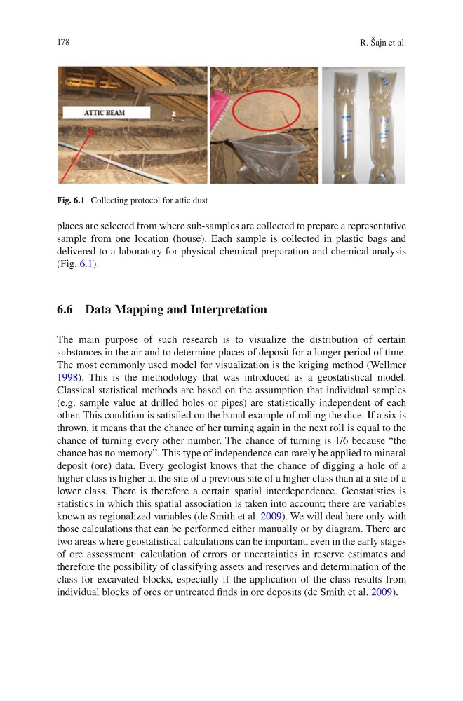
places are selected from where sub-samples are collected to prepare a representative
sample from one location (house). Each sample is collected in plastic bags and
delivered to a laboratory for physical-chemical preparation and chemical analysis
(Fig. 6.1).
6.6 Data Mapping and Interpretation
The main purpose of such research is to visualize the distribution of certain
substances in the air and to determine places of deposit for a longer period of time.
The most commonly used model for visualization is the kriging method (Wellmer
1998). This is the methodology that was introduced as a geostatistical model.
Classical statistical methods are based on the assumption that individual samples
(e.g. sample value at drilled holes or pipes) are statistically independent of each
other. This condition is satisfied on the banal example of rolling the dice. If a six is
thrown, it means that the chance of her turning again in the next roll is equal to the
chance of turning every other number. The chance of turning is 1/6 because “the
chance has no memory”. This type of independence can rarely be applied to mineral
deposit (ore) data. Every geologist knows that the chance of digging a hole of a
higher class is higher at the site of a previous site of a higher class than at a site of a
lower class. There is therefore a certain spatial interdependence. Geostatistics is
statistics in which this spatial association is taken into account; there are variables
known as regionalized variables (de Smith et al. 2009). We will deal here only with
those calculations that can be performed either manually or by diagram. There are
two areas where geostatistical calculations can be important, even in the early stages
of ore assessment: calculation of errors or uncertainties in reserve estimates and
therefore the possibility of classifying assets and reserves and determination of the
class for excavated blocks, especially if the application of the class results from
individual blocks of ores or untreated finds in ore deposits (de Smith et al. 2009).
Fig. 6.1 Collecting protocol for attic dust
R. Šajn et al.
places are selected from where sub-samples are collected to prepare a representative
sample from one location (house). Each sample is collected in plastic bags and
delivered to a laboratory for physical-chemical preparation and chemical analysis
(Fig. 6.1).
6.6 Data Mapping and Interpretation
The main purpose of such research is to visualize the distribution of certain
substances in the air and to determine places of deposit for a longer period of time.
The most commonly used model for visualization is the kriging method (Wellmer
1998). This is the methodology that was introduced as a geostatistical model.
Classical statistical methods are based on the assumption that individual samples
(e.g. sample value at drilled holes or pipes) are statistically independent of each
other. This condition is satisfied on the banal example of rolling the dice. If a six is
thrown, it means that the chance of her turning again in the next roll is equal to the
chance of turning every other number. The chance of turning is 1/6 because “the
chance has no memory”. This type of independence can rarely be applied to mineral
deposit (ore) data. Every geologist knows that the chance of digging a hole of a
higher class is higher at the site of a previous site of a higher class than at a site of a
lower class. There is therefore a certain spatial interdependence. Geostatistics is
statistics in which this spatial association is taken into account; there are variables
known as regionalized variables (de Smith et al. 2009). We will deal here only with
those calculations that can be performed either manually or by diagram. There are
two areas where geostatistical calculations can be important, even in the early stages
of ore assessment: calculation of errors or uncertainties in reserve estimates and
therefore the possibility of classifying assets and reserves and determination of the
class for excavated blocks, especially if the application of the class results from
individual blocks of ores or untreated finds in ore deposits (de Smith et al. 2009).
Fig. 6.1 Collecting protocol for attic dust
R. Šajn et al.