

Carbon Footprint of Karnataka: Accounting of Sources and Sinks
57
with the current trends of changes and also likely changes due to the policy of large
scale developmental projects; and (vi) suggestions towards reducing deforestation
and land degradation.
2 Materials and Method
2.1 Study Area
Karnataka covers an area of 191,976 km
2 (19 million hectares) with a share of 6%
in the national GDP is located in the southern part of India, sharing borders with
Maharashtra and Goa; Andhra Pradesh and Telangana to the east; Tamil Nadu and
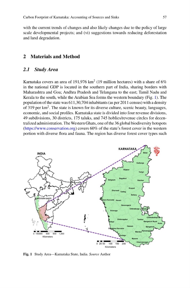
Kerala to the south, while the Arabian Sea forms the western boundary (Fig. 1). The
population of the state was 611,30,704 inhabitants (as per 2011 census) with a density
of 319 per km
2 . The state is known for its diverse culture, scenic beauty, languages,
economic, and social profiles. Karnataka state is divided into four revenue divisions,
49 subdivisions, 30 districts, 175 taluks, and 745 hoblies/revenue circles for decentralized administration. The Western Ghats, one of the 36 global biodiversity hotspots
(https://www.conservation.org) covers 60% of the state’s forest cover in the western
portion with diverse flora and fauna. The region has diverse forest cover types such
Fig. 1 Study Area—Karnataka State, India. Source Author
57
with the current trends of changes and also likely changes due to the policy of large
scale developmental projects; and (vi) suggestions towards reducing deforestation
and land degradation.
2 Materials and Method
2.1 Study Area
Karnataka covers an area of 191,976 km
2 (19 million hectares) with a share of 6%
in the national GDP is located in the southern part of India, sharing borders with
Maharashtra and Goa; Andhra Pradesh and Telangana to the east; Tamil Nadu and
Kerala to the south, while the Arabian Sea forms the western boundary (Fig. 1). The
population of the state was 611,30,704 inhabitants (as per 2011 census) with a density
of 319 per km
2 . The state is known for its diverse culture, scenic beauty, languages,
economic, and social profiles. Karnataka state is divided into four revenue divisions,
49 subdivisions, 30 districts, 175 taluks, and 745 hoblies/revenue circles for decentralized administration. The Western Ghats, one of the 36 global biodiversity hotspots
(https://www.conservation.org) covers 60% of the state’s forest cover in the western
portion with diverse flora and fauna. The region has diverse forest cover types such
Fig. 1 Study Area—Karnataka State, India. Source Author