

Archaeological Sites in Dakhla Oasis, Western Desert, Egypt
83
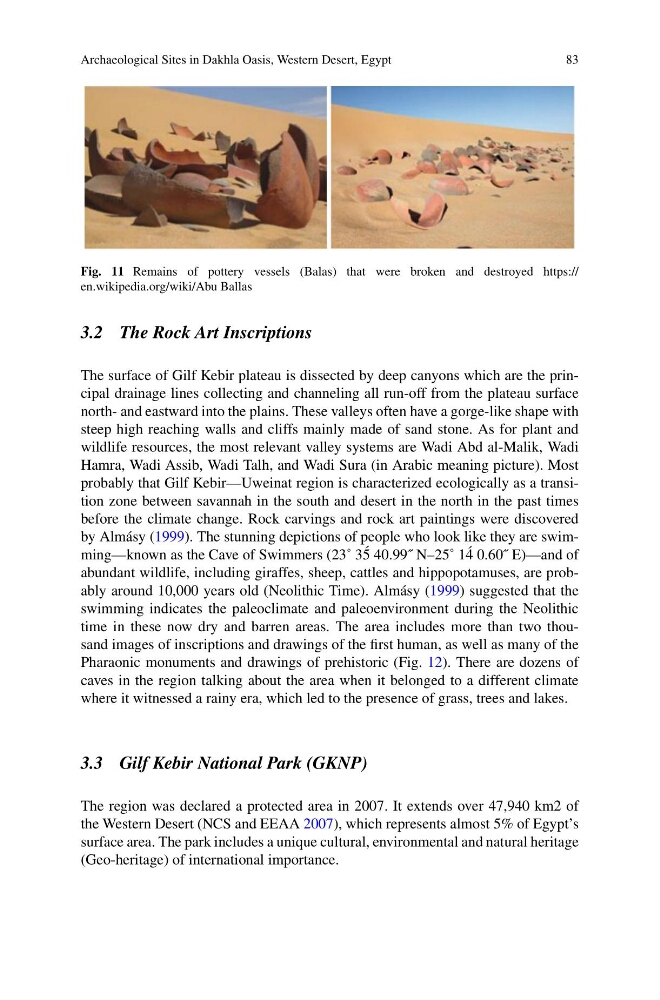
Fig. 11 Remains of pottery vessels (Balas) that were broken and destroyed https://
en.wikipedia.org/wiki/Abu Ballas
3.2 The Rock Art Inscriptions
The surface of Gilf Kebir plateau is dissected by deep canyons which are the principal drainage lines collecting and channeling all run-off from the plateau surface
north- and eastward into the plains. These valleys often have a gorge-like shape with
steep high reaching walls and cliffs mainly made of sand stone. As for plant and
wildlife resources, the most relevant valley systems are Wadi Abd al-Malik, Wadi
Hamra, Wadi Assib, Wadi Talh, and Wadi Sura (in Arabic meaning picture). Most
probably that Gilf Kebir—Uweinat region is characterized ecologically as a transition zone between savannah in the south and desert in the north in the past times
before the climate change. Rock carvings and rock art paintings were discovered
by Almásy (1999). The stunning depictions of people who look like they are swimming—known as the Cave of Swimmers (23˚ 3 ´
5 40.99˝ N–25˚ 1 ´
4 0.60˝ E)—and of
abundant wildlife, including giraffes, sheep, cattles and hippopotamuses, are probably around 10,000 years old (Neolithic Time). Almásy (1999) suggested that the
swimming indicates the paleoclimate and paleoenvironment during the Neolithic
time in these now dry and barren areas. The area includes more than two thousand images of inscriptions and drawings of the first human, as well as many of the
Pharaonic monuments and drawings of prehistoric (Fig. 12). There are dozens of
caves in the region talking about the area when it belonged to a different climate
where it witnessed a rainy era, which led to the presence of grass, trees and lakes.
3.3 Gilf Kebir National Park (GKNP)
The region was declared a protected area in 2007. It extends over 47,940 km2 of
the Western Desert (NCS and EEAA 2007), which represents almost 5% of Egypt’s
surface area. The park includes a unique cultural, environmental and natural heritage
(Geo-heritage) of international importance.
83
Fig. 11 Remains of pottery vessels (Balas) that were broken and destroyed https://
en.wikipedia.org/wiki/Abu Ballas
3.2 The Rock Art Inscriptions
The surface of Gilf Kebir plateau is dissected by deep canyons which are the principal drainage lines collecting and channeling all run-off from the plateau surface
north- and eastward into the plains. These valleys often have a gorge-like shape with
steep high reaching walls and cliffs mainly made of sand stone. As for plant and
wildlife resources, the most relevant valley systems are Wadi Abd al-Malik, Wadi
Hamra, Wadi Assib, Wadi Talh, and Wadi Sura (in Arabic meaning picture). Most
probably that Gilf Kebir—Uweinat region is characterized ecologically as a transition zone between savannah in the south and desert in the north in the past times
before the climate change. Rock carvings and rock art paintings were discovered
by Almásy (1999). The stunning depictions of people who look like they are swimming—known as the Cave of Swimmers (23˚ 3 ´
5 40.99˝ N–25˚ 1 ´
4 0.60˝ E)—and of
abundant wildlife, including giraffes, sheep, cattles and hippopotamuses, are probably around 10,000 years old (Neolithic Time). Almásy (1999) suggested that the
swimming indicates the paleoclimate and paleoenvironment during the Neolithic
time in these now dry and barren areas. The area includes more than two thousand images of inscriptions and drawings of the first human, as well as many of the
Pharaonic monuments and drawings of prehistoric (Fig. 12). There are dozens of
caves in the region talking about the area when it belonged to a different climate
where it witnessed a rainy era, which led to the presence of grass, trees and lakes.
3.3 Gilf Kebir National Park (GKNP)
The region was declared a protected area in 2007. It extends over 47,940 km2 of
the Western Desert (NCS and EEAA 2007), which represents almost 5% of Egypt’s
surface area. The park includes a unique cultural, environmental and natural heritage
(Geo-heritage) of international importance.