

58
A. M. A. Mohamed
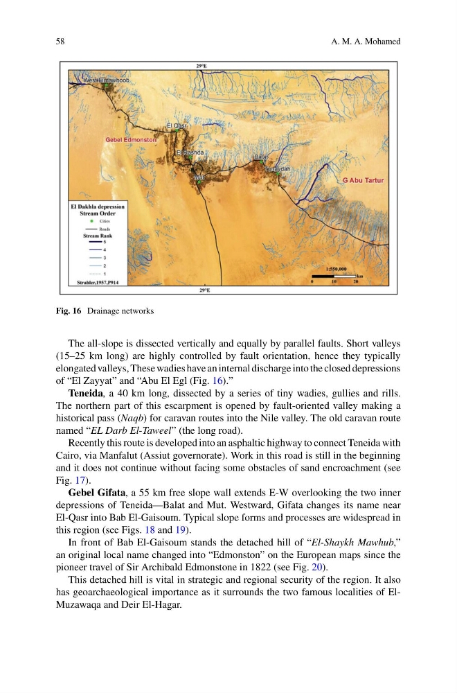
Fig. 16 Drainage networks
The all-slope is dissected vertically and equally by parallel faults. Short valleys
(15–25 km long) are highly controlled by fault orientation, hence they typically
elongated valleys, These wadies have an internal discharge into the closed depressions
of “El Zayyat” and “Abu El Egl (Fig. 16).”
Teneida, a 40 km long, dissected by a series of tiny wadies, gullies and rills.
The northern part of this escarpment is opened by fault-oriented valley making a
historical pass (Naqb) for caravan routes into the Nile valley. The old caravan route
named “EL Darb El-Taweel” (the long road).
Recently this route is developed into an asphaltic highway to connect Teneida with
Cairo, via Manfalut (Assiut governorate). Work in this road is still in the beginning
and it does not continue without facing some obstacles of sand encroachment (see
Fig. 17).
Gebel Gifata, a 55 km free slope wall extends E-W overlooking the two inner
depressions of Teneida—Balat and Mut. Westward, Gifata changes its name near
El-Qasr into Bab El-Gaisoum. Typical slope forms and processes are widespread in
this region (see Figs. 18 and 19).
In front of Bab El-Gaisoum stands the detached hill of “El-Shaykh Mawhub,”
an original local name changed into “Edmonston” on the European maps since the
pioneer travel of Sir Archibald Edmonstone in 1822 (see Fig. 20).
This detached hill is vital in strategic and regional security of the region. It also
has geoarchaeological importance as it surrounds the two famous localities of ElMuzawaqa and Deir El-Hagar.
A. M. A. Mohamed
Fig. 16 Drainage networks
The all-slope is dissected vertically and equally by parallel faults. Short valleys
(15–25 km long) are highly controlled by fault orientation, hence they typically
elongated valleys, These wadies have an internal discharge into the closed depressions
of “El Zayyat” and “Abu El Egl (Fig. 16).”
Teneida, a 40 km long, dissected by a series of tiny wadies, gullies and rills.
The northern part of this escarpment is opened by fault-oriented valley making a
historical pass (Naqb) for caravan routes into the Nile valley. The old caravan route
named “EL Darb El-Taweel” (the long road).
Recently this route is developed into an asphaltic highway to connect Teneida with
Cairo, via Manfalut (Assiut governorate). Work in this road is still in the beginning
and it does not continue without facing some obstacles of sand encroachment (see
Fig. 17).
Gebel Gifata, a 55 km free slope wall extends E-W overlooking the two inner
depressions of Teneida—Balat and Mut. Westward, Gifata changes its name near
El-Qasr into Bab El-Gaisoum. Typical slope forms and processes are widespread in
this region (see Figs. 18 and 19).
In front of Bab El-Gaisoum stands the detached hill of “El-Shaykh Mawhub,”
an original local name changed into “Edmonston” on the European maps since the
pioneer travel of Sir Archibald Edmonstone in 1822 (see Fig. 20).
This detached hill is vital in strategic and regional security of the region. It also
has geoarchaeological importance as it surrounds the two famous localities of ElMuzawaqa and Deir El-Hagar.