

46
A. M. A. Mohamed
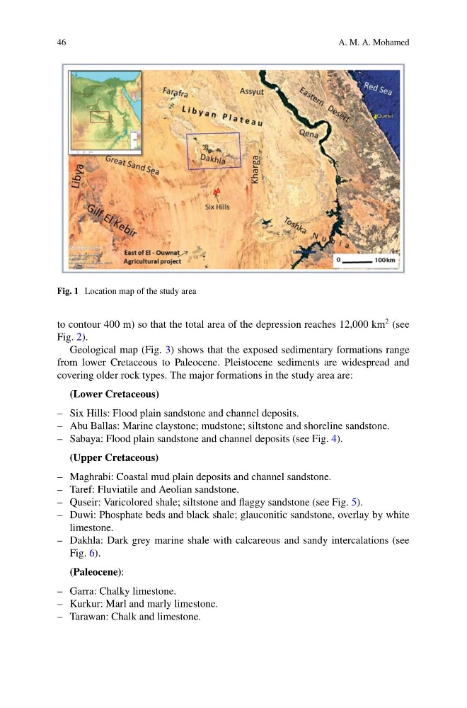
Fig. 1 Location map of the study area
to contour 400 m) so that the total area of the depression reaches 12,000 km
2 (see
Fig. 2).
Geological map (Fig. 3) shows that the exposed sedimentary formations range
from lower Cretaceous to Paleocene. Pleistocene sediments are widespread and
covering older rock types. The major formations in the study area are:
(Lower Cretaceous)
– Six Hills: Flood plain sandstone and channel deposits.
– Abu Ballas: Marine claystone; mudstone; siltstone and shoreline sandstone.
– Sabaya: Flood plain sandstone and channel deposits (see Fig. 4).
(Upper Cretaceous)
– Maghrabi: Coastal mud plain deposits and channel sandstone.
– Taref: Fluviatile and Aeolian sandstone.
– Quseir: Varicolored shale; siltstone and flaggy sandstone (see Fig. 5).
– Duwi: Phosphate beds and black shale; glauconitic sandstone, overlay by white
limestone.
– Dakhla: Dark grey marine shale with calcareous and sandy intercalations (see
Fig. 6).
(Paleocene):
– Garra: Chalky limestone.
– Kurkur: Marl and marly limestone.
– Tarawan: Chalk and limestone.
A. M. A. Mohamed
Fig. 1 Location map of the study area
to contour 400 m) so that the total area of the depression reaches 12,000 km
2 (see
Fig. 2).
Geological map (Fig. 3) shows that the exposed sedimentary formations range
from lower Cretaceous to Paleocene. Pleistocene sediments are widespread and
covering older rock types. The major formations in the study area are:
(Lower Cretaceous)
– Six Hills: Flood plain sandstone and channel deposits.
– Abu Ballas: Marine claystone; mudstone; siltstone and shoreline sandstone.
– Sabaya: Flood plain sandstone and channel deposits (see Fig. 4).
(Upper Cretaceous)
– Maghrabi: Coastal mud plain deposits and channel sandstone.
– Taref: Fluviatile and Aeolian sandstone.
– Quseir: Varicolored shale; siltstone and flaggy sandstone (see Fig. 5).
– Duwi: Phosphate beds and black shale; glauconitic sandstone, overlay by white
limestone.
– Dakhla: Dark grey marine shale with calcareous and sandy intercalations (see
Fig. 6).
(Paleocene):
– Garra: Chalky limestone.
– Kurkur: Marl and marly limestone.
– Tarawan: Chalk and limestone.