

30
E. A. Zaghloul
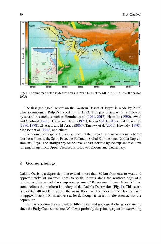
Fig. 1 Location map of the study area overlaid over a DEM of the SRTM-03 (USGS 2004; NASA
2005)
The first geological report on the Western Desert of Egypt is made by Zittel
who accompanied Rolph’s Expedition in 1883. This pioneering work is followed
by several researchers such as Hermina et al. (1961, 2017), Hermina (1990), Awad
and Ghobrial (1965), Abbas and Habib (1971), Issawi (1971, 1972), El-Deftar et al.
(1970, 1978), El- Azabi and El-Araby (2000), Tantawy et al. (2001), Hewaidy (1990),
Mansour et al. (1982) and others.
The geomorphology of the area is under different geomorphic zones namely the
Northern Plateau, the Scarp Face, the Pediment, Gabal Edmonstone, Dakhla Depression and Playa. The stratigraphy of the area is characterized by the exposed rock unit
ranging in age from Upper Cretaceous to Lower Eocene and Quaternary.
2 Geomorphology
Dakhla Oasis is a depression that extends more than 80 km from east to west and
approximately 30 km from north to south. It rests along the southern edge of a
sandstone plateau and the steep escarpment of Paleocene—Lower Eocene limestone defines the northern boundary of the Dakhla Depression (Fig. 1). This scarp
is elevated 400–500 m above the oasis floor and the floor of the Dakhla basin
is approximately 100 m above sea level, though it varies in elevation across the
depression.
This oasis occurred as a result of lithological and geological changes occurring
since the Early Cretaceous time. Wind was probably the primary agent for excavating
E. A. Zaghloul
Fig. 1 Location map of the study area overlaid over a DEM of the SRTM-03 (USGS 2004; NASA
2005)
The first geological report on the Western Desert of Egypt is made by Zittel
who accompanied Rolph’s Expedition in 1883. This pioneering work is followed
by several researchers such as Hermina et al. (1961, 2017), Hermina (1990), Awad
and Ghobrial (1965), Abbas and Habib (1971), Issawi (1971, 1972), El-Deftar et al.
(1970, 1978), El- Azabi and El-Araby (2000), Tantawy et al. (2001), Hewaidy (1990),
Mansour et al. (1982) and others.
The geomorphology of the area is under different geomorphic zones namely the
Northern Plateau, the Scarp Face, the Pediment, Gabal Edmonstone, Dakhla Depression and Playa. The stratigraphy of the area is characterized by the exposed rock unit
ranging in age from Upper Cretaceous to Lower Eocene and Quaternary.
2 Geomorphology
Dakhla Oasis is a depression that extends more than 80 km from east to west and
approximately 30 km from north to south. It rests along the southern edge of a
sandstone plateau and the steep escarpment of Paleocene—Lower Eocene limestone defines the northern boundary of the Dakhla Depression (Fig. 1). This scarp
is elevated 400–500 m above the oasis floor and the floor of the Dakhla basin
is approximately 100 m above sea level, though it varies in elevation across the
depression.
This oasis occurred as a result of lithological and geological changes occurring
since the Early Cretaceous time. Wind was probably the primary agent for excavating