

250
E.-S. E. Omran
Kharga. The flood irrigation system is dominant and the lack of good agricultural
drainage has resulted in soil salinization and increased waterlogged soil area.
In the eastern region, which has the largest villages, agriculture is typically dominated. Usually, most of Kharga Oasis soil is deep sandy, sandy to deep clay, rocky,
sandy, mud-clay sand over deep clay, and shallow mud. Based on hydrogeological
studies and projections of computational model for potential horizontal expansion by
international, it is not advised to raise reclaimed areas in Kharga as the current cloud
(110.30 million cubic meters per year) should not be surpassed for the Byzantine
collapse and then the need for self-flowing wells has led to a decrease in the water
table.
4 Case 2: Dakhla Oasis
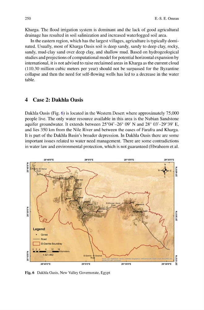
Dakhla Oasis (Fig. 6) is located in the Western Desert where approximately 75,000
people live. The only water resource available in this area is the Nubian Sandstone
aquifer groundwater. It extends between 25°04’–26° 09
N and 28° 03
–29°39
E,
and lies 350 km from the Nile River and between the oases of Farafra and Kharga.
It is part of the Dakhla Basin’s broader depression. In Dakhla Oasis there are some
important issues related to water need management. There are some contradictions
in water law and environmental protection, which is not guaranteed (Ebraheem et al.
Fig. 6 Dakhla Oasis, New Valley Governorate, Egypt
E.-S. E. Omran
Kharga. The flood irrigation system is dominant and the lack of good agricultural
drainage has resulted in soil salinization and increased waterlogged soil area.
In the eastern region, which has the largest villages, agriculture is typically dominated. Usually, most of Kharga Oasis soil is deep sandy, sandy to deep clay, rocky,
sandy, mud-clay sand over deep clay, and shallow mud. Based on hydrogeological
studies and projections of computational model for potential horizontal expansion by
international, it is not advised to raise reclaimed areas in Kharga as the current cloud
(110.30 million cubic meters per year) should not be surpassed for the Byzantine
collapse and then the need for self-flowing wells has led to a decrease in the water
table.
4 Case 2: Dakhla Oasis
Dakhla Oasis (Fig. 6) is located in the Western Desert where approximately 75,000
people live. The only water resource available in this area is the Nubian Sandstone
aquifer groundwater. It extends between 25°04’–26° 09
N and 28° 03
–29°39
E,
and lies 350 km from the Nile River and between the oases of Farafra and Kharga.
It is part of the Dakhla Basin’s broader depression. In Dakhla Oasis there are some
important issues related to water need management. There are some contradictions
in water law and environmental protection, which is not guaranteed (Ebraheem et al.
Fig. 6 Dakhla Oasis, New Valley Governorate, Egypt