

Hydrologeological and Hydrological …
189
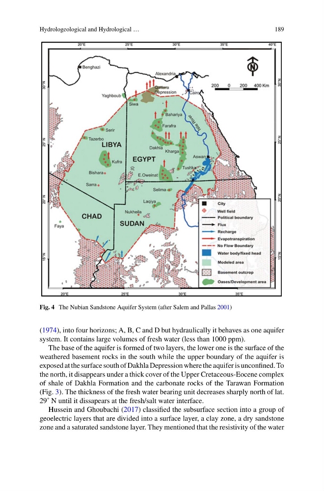
Fig. 4 The Nubian Sandstone Aquifer System (after Salem and Pallas 2001)
(1974), into four horizons; A, B, C and D but hydraulically it behaves as one aquifer
system. It contains large volumes of fresh water (less than 1000 ppm).
The base of the aquifer is formed of two layers, the lower one is the surface of the
weathered basement rocks in the south while the upper boundary of the aquifer is
exposed at the surface south of Dakhla Depression where the aquifer is unconfined. To
the north, it disappears under a thick cover of the Upper Cretaceous-Eocene complex
of shale of Dakhla Formation and the carbonate rocks of the Tarawan Formation
(Fig. 3). The thickness of the fresh water bearing unit decreases sharply north of lat.
29˚ N until it dissapears at the fresh/salt water interface.
Hussein and Ghoubachi (2017) classified the subsurface section into a group of
geoelectric layers that are divided into a surface layer, a clay zone, a dry sandstone
zone and a saturated sandstone layer. They mentioned that the resistivity of the water
189
Fig. 4 The Nubian Sandstone Aquifer System (after Salem and Pallas 2001)
(1974), into four horizons; A, B, C and D but hydraulically it behaves as one aquifer
system. It contains large volumes of fresh water (less than 1000 ppm).
The base of the aquifer is formed of two layers, the lower one is the surface of the
weathered basement rocks in the south while the upper boundary of the aquifer is
exposed at the surface south of Dakhla Depression where the aquifer is unconfined. To
the north, it disappears under a thick cover of the Upper Cretaceous-Eocene complex
of shale of Dakhla Formation and the carbonate rocks of the Tarawan Formation
(Fig. 3). The thickness of the fresh water bearing unit decreases sharply north of lat.
29˚ N until it dissapears at the fresh/salt water interface.
Hussein and Ghoubachi (2017) classified the subsurface section into a group of
geoelectric layers that are divided into a surface layer, a clay zone, a dry sandstone
zone and a saturated sandstone layer. They mentioned that the resistivity of the water