

150
A. Shalaby and H. S. Khedr
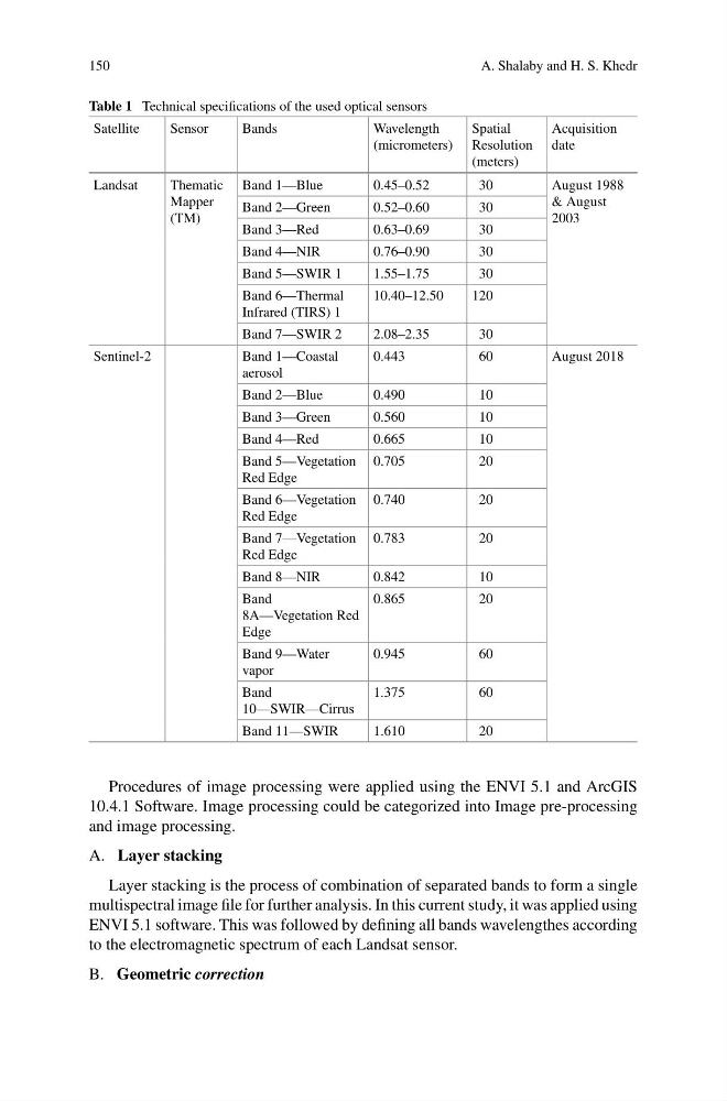
Table 1 Technical specifications of the used optical sensors
Satellite
Sensor
Bands
Wavelength
(micrometers)
Spatial
Resolution
(meters)
Acquisition
date
Landsat
Thematic
Mapper
(TM)
Band 1—Blue
0.45–0.52
30
August 1988
& August
2003
Band 2—Green
0.52–0.60
30
Band 3—Red
0.63–0.69
30
Band 4—NIR
0.76–0.90
30
Band 5—SWIR 1
1.55–1.75
30
Band 6—Thermal
Infrared (TIRS) 1
10.40–12.50
120
Band 7—SWIR 2
2.08–2.35
30
Sentinel-2
Band 1—Coastal
aerosol
0.443
60
August 2018
Band 2—Blue
0.490
10
Band 3—Green
0.560
10
Band 4—Red
0.665
10
Band 5—Vegetation
Red Edge
0.705
20
Band 6—Vegetation
Red Edge
0.740
20
Band 7—Vegetation
Red Edge
0.783
20
Band 8—NIR
0.842
10
Band
8A—Vegetation Red
Edge
0.865
20
Band 9—Water
vapor
0.945
60
Band
10—SWIR—Cirrus
1.375
60
Band 11—SWIR
1.610
20
Procedures of image processing were applied using the ENVI 5.1 and ArcGIS
10.4.1 Software. Image processing could be categorized into Image pre-processing
and image processing.
A. Layer stacking
Layer stacking is the process of combination of separated bands to form a single
multispectral image file for further analysis. In this current study, it was applied using
ENVI 5.1 software. This was followed by defining all bands wavelengthes according
to the electromagnetic spectrum of each Landsat sensor.
B. Geometric correction
A. Shalaby and H. S. Khedr
Table 1 Technical specifications of the used optical sensors
Satellite
Sensor
Bands
Wavelength
(micrometers)
Spatial
Resolution
(meters)
Acquisition
date
Landsat
Thematic
Mapper
(TM)
Band 1—Blue
0.45–0.52
30
August 1988
& August
2003
Band 2—Green
0.52–0.60
30
Band 3—Red
0.63–0.69
30
Band 4—NIR
0.76–0.90
30
Band 5—SWIR 1
1.55–1.75
30
Band 6—Thermal
Infrared (TIRS) 1
10.40–12.50
120
Band 7—SWIR 2
2.08–2.35
30
Sentinel-2
Band 1—Coastal
aerosol
0.443
60
August 2018
Band 2—Blue
0.490
10
Band 3—Green
0.560
10
Band 4—Red
0.665
10
Band 5—Vegetation
Red Edge
0.705
20
Band 6—Vegetation
Red Edge
0.740
20
Band 7—Vegetation
Red Edge
0.783
20
Band 8—NIR
0.842
10
Band
8A—Vegetation Red
Edge
0.865
20
Band 9—Water
vapor
0.945
60
Band
10—SWIR—Cirrus
1.375
60
Band 11—SWIR
1.610
20
Procedures of image processing were applied using the ENVI 5.1 and ArcGIS
10.4.1 Software. Image processing could be categorized into Image pre-processing
and image processing.
A. Layer stacking
Layer stacking is the process of combination of separated bands to form a single
multispectral image file for further analysis. In this current study, it was applied using
ENVI 5.1 software. This was followed by defining all bands wavelengthes according
to the electromagnetic spectrum of each Landsat sensor.
B. Geometric correction