

2 Landscape Change in Europe
25
Table 2.1 (continued)
Study
Approach
Major contribution to landscape
change research in Europe
Lieskovský and Bürgi (2018)
Cross-site comparison and
large-scale analysis
Presented an innovative
approach to studying patterns of
landscape stability and the
corresponding stabilising
factors. The paper developed a
persistence index, and combined
different scales of analysis using
historical land cover and
topographic maps
Verkerk et al. (2018)
Large-scale analysis
Built on existing participatory
scenarios of desired land use
configuration in Europe and
plausible future projections
based on current conditions to
identify potential policy
pathways to link the two
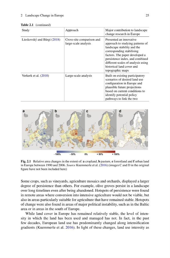
Fig. 2.1 Relative area changes in the extent of: a cropland, b pasture, e forestland and f urban land
in Europe between 1990 and 2006. Source Kuemmerle et al. (2016) (images C and D in the original
figure have not been included here)
Some crops, such as vineyards, agriculture mosaics and orchards, displayed a larger
degree of persistence than others. For example, olive groves persist in a landscape
over long timelines even after being abandoned. Hotspots of persistence were found
in remote areas where conversion into intensive agriculture would not be viable, but
also in areas particularly suitable for agriculture that have remained stable. Hotspots
of change were also found in areas of major political instability, such as in the Baltic
area or in areas in the south of Europe.
While land cover in Europe has remained relatively stable, the level of intensity in which the land has been used and managed has not. In fact, in the past
few decades, European land use has predominantly changed along intensification
gradients (Kuemmerle et al. 2016). In light of these changes, land use intensity as
25
Table 2.1 (continued)
Study
Approach
Major contribution to landscape
change research in Europe
Lieskovský and Bürgi (2018)
Cross-site comparison and
large-scale analysis
Presented an innovative
approach to studying patterns of
landscape stability and the
corresponding stabilising
factors. The paper developed a
persistence index, and combined
different scales of analysis using
historical land cover and
topographic maps
Verkerk et al. (2018)
Large-scale analysis
Built on existing participatory
scenarios of desired land use
configuration in Europe and
plausible future projections
based on current conditions to
identify potential policy
pathways to link the two
Fig. 2.1 Relative area changes in the extent of: a cropland, b pasture, e forestland and f urban land
in Europe between 1990 and 2006. Source Kuemmerle et al. (2016) (images C and D in the original
figure have not been included here)
Some crops, such as vineyards, agriculture mosaics and orchards, displayed a larger
degree of persistence than others. For example, olive groves persist in a landscape
over long timelines even after being abandoned. Hotspots of persistence were found
in remote areas where conversion into intensive agriculture would not be viable, but
also in areas particularly suitable for agriculture that have remained stable. Hotspots
of change were also found in areas of major political instability, such as in the Baltic
area or in areas in the south of Europe.
While land cover in Europe has remained relatively stable, the level of intensity in which the land has been used and managed has not. In fact, in the past
few decades, European land use has predominantly changed along intensification
gradients (Kuemmerle et al. 2016). In light of these changes, land use intensity as