

3000 mm, and 5–8 °C, respectively. This climate zone
includes the Nansei Islands to the north of the Tokara
channel and the coastal region of Kyushu excluding the Seto
Inland Sea coastal region in Oita Prefecture. Deciduous
broad-leaved trees typified by chinquapin trees (Castanopsis
cuspidate spp.) and cinnamon (Cinnamomum camphora)are
mainly distributed.
(3) Subtropical zone
The annual average temperature and annual precipitation are
17 °C or more and about 2000–4000 mm, respectively. This
climate zone has monthly average temperatures of 20 °C or
more for six to eight months a year and does not experience
freezing temperatures. The annual range in temperature and
precipitation is small. This climate zone includes the Nansei
Islands to the south of the Tokara channel. Among evergreen
broad-leaved trees, many tropical plants such as epiphytes
and wood ferns grow abundantly.
(4) Setouchi climate zone
The annual average temperature, annual precipitation, and
average temperature in January are 15–16 °C, 1400–
1600 mm, and 5–6 °C, respectively. The Seto Inland Sea
coastal region of Oita Prefecture belongs to this climate
zone. Evergreen broad-leaved trees are mainly distributed in
this zone. This zone experiences less snow in winter and less
rainfall in summer.
2. Geomorphology and geology
The geomorphology and geology of the Kyushu–Okinawa
region is divided into four parts: (1) the central part, characterized by a volcanic graben zone (the Beppu–Shimabara
graben) crossing central Kyushu and outstanding volcanoes;
(2) the northern part, in the north of central Kyushu; (3) the
southern part, in the south of central Kyushu; and (4) the
Nansei Islands (Machida et al. 2001). The northern margin of
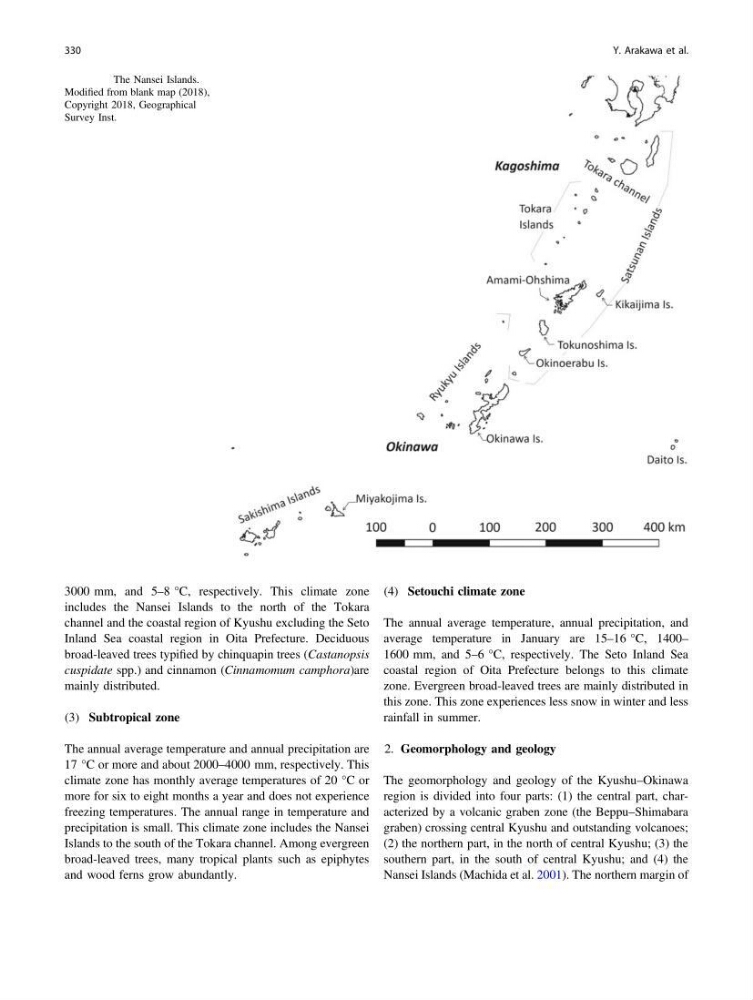
Fig. 10.2 The Nansei Islands.
Modified from blank map (2018),
Copyright 2018, Geographical
Survey Inst.
330
Y. Arakawa et al.
includes the Nansei Islands to the north of the Tokara
channel and the coastal region of Kyushu excluding the Seto
Inland Sea coastal region in Oita Prefecture. Deciduous
broad-leaved trees typified by chinquapin trees (Castanopsis
cuspidate spp.) and cinnamon (Cinnamomum camphora)are
mainly distributed.
(3) Subtropical zone
The annual average temperature and annual precipitation are
17 °C or more and about 2000–4000 mm, respectively. This
climate zone has monthly average temperatures of 20 °C or
more for six to eight months a year and does not experience
freezing temperatures. The annual range in temperature and
precipitation is small. This climate zone includes the Nansei
Islands to the south of the Tokara channel. Among evergreen
broad-leaved trees, many tropical plants such as epiphytes
and wood ferns grow abundantly.
(4) Setouchi climate zone
The annual average temperature, annual precipitation, and
average temperature in January are 15–16 °C, 1400–
1600 mm, and 5–6 °C, respectively. The Seto Inland Sea
coastal region of Oita Prefecture belongs to this climate
zone. Evergreen broad-leaved trees are mainly distributed in
this zone. This zone experiences less snow in winter and less
rainfall in summer.
2. Geomorphology and geology
The geomorphology and geology of the Kyushu–Okinawa
region is divided into four parts: (1) the central part, characterized by a volcanic graben zone (the Beppu–Shimabara
graben) crossing central Kyushu and outstanding volcanoes;
(2) the northern part, in the north of central Kyushu; (3) the
southern part, in the south of central Kyushu; and (4) the
Nansei Islands (Machida et al. 2001). The northern margin of
Fig. 10.2 The Nansei Islands.
Modified from blank map (2018),
Copyright 2018, Geographical
Survey Inst.
330
Y. Arakawa et al.