

250
A. P. Sari et al.
Table 12.1 Selected criteria for mapping out peatlands restoration priority areas
Priority 1
Areas burnt in the 2015 fires
Priority 2
Protected areas not burnt in the 2015 fires with existing drainage canals
Priority 3
Protected areas not burnt in 2015 fires without drainage canals
Priority 4
Other areas with drainage canals
Table 12.2 Classification of
area permits under the BRG
contingency plan
Area permit classification
Size area (ha)
Cultivation areas with permit (concessions)
1,410,943
Cultivation areas without a permit
396,945
Protected areas
684,638
Total
2,492,527
By the end of this year (2018), BRG is expected to accomplish 70% of its restoration target, whereas the remaining 20 and 10% will be implemented in 2019 and
2020, respectively.
The BRG Contingency Plan shows a plan to restore a vast area of almost 2.5 Mha
up to the year 2020 (e.g. Chief of BRG (Badan Restorasi Gambut, the Peat Restoration
Agency).
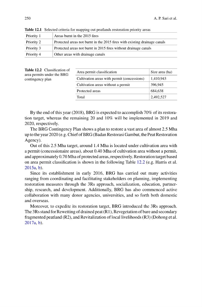
Out of this 2.5 Mha target, around 1.4 Mha is located under cultivation area with
a permit (concessionaire areas), about 0.40 Mha of cultivation area without a permit,
and approximately 0.70 Mha of protected areas, respectively. Restoration target based
on area permit classification is shown in the following Table 12.2 (e.g. Harris et al.
2015a, b).
Since its establishment in early 2016, BRG has carried out many activities
ranging from coordinating and facilitating stakeholders on planning, implementing
restoration measures through the 3Rs approach, socialization, education, partnership, research, and development. Additionally, BRG has also commenced active
collaboration with many donor agencies, universities, and so forth both domestic
and overseas.
Moreover, to expedite its restoration target, BRG introduced the 3Rs approach.
The 3Rs stand for Rewetting of drained peat (R1), Revegetation of bare and secondary
fragmented peatland (R2), and Revitalization of local livelihoods (R3) (Dohong et al.
2017a, b).
A. P. Sari et al.
Table 12.1 Selected criteria for mapping out peatlands restoration priority areas
Priority 1
Areas burnt in the 2015 fires
Priority 2
Protected areas not burnt in the 2015 fires with existing drainage canals
Priority 3
Protected areas not burnt in 2015 fires without drainage canals
Priority 4
Other areas with drainage canals
Table 12.2 Classification of
area permits under the BRG
contingency plan
Area permit classification
Size area (ha)
Cultivation areas with permit (concessions)
1,410,943
Cultivation areas without a permit
396,945
Protected areas
684,638
Total
2,492,527
By the end of this year (2018), BRG is expected to accomplish 70% of its restoration target, whereas the remaining 20 and 10% will be implemented in 2019 and
2020, respectively.
The BRG Contingency Plan shows a plan to restore a vast area of almost 2.5 Mha
up to the year 2020 (e.g. Chief of BRG (Badan Restorasi Gambut, the Peat Restoration
Agency).
Out of this 2.5 Mha target, around 1.4 Mha is located under cultivation area with
a permit (concessionaire areas), about 0.40 Mha of cultivation area without a permit,
and approximately 0.70 Mha of protected areas, respectively. Restoration target based
on area permit classification is shown in the following Table 12.2 (e.g. Harris et al.
2015a, b).
Since its establishment in early 2016, BRG has carried out many activities
ranging from coordinating and facilitating stakeholders on planning, implementing
restoration measures through the 3Rs approach, socialization, education, partnership, research, and development. Additionally, BRG has also commenced active
collaboration with many donor agencies, universities, and so forth both domestic
and overseas.
Moreover, to expedite its restoration target, BRG introduced the 3Rs approach.
The 3Rs stand for Rewetting of drained peat (R1), Revegetation of bare and secondary
fragmented peatland (R2), and Revitalization of local livelihoods (R3) (Dohong et al.
2017a, b).