

Determination of Best-Fit Probability Distribution …
67
2 Data and Description
This study uses monthly rainfall data recorded in four meteorological stations in
Sikkim from 1951 to 1999. The data is obtained from the study titled Carrying
Capacity Study of Teesta Basin in Sikkim by Centre for Interdisciplinary Studies
of Mountain and Hill Environment (CISMHE), University of Delhi under the
supervision of Ministry of Environment and Forests, Government of India.
The stations in the study were selected based on the availability of data. The
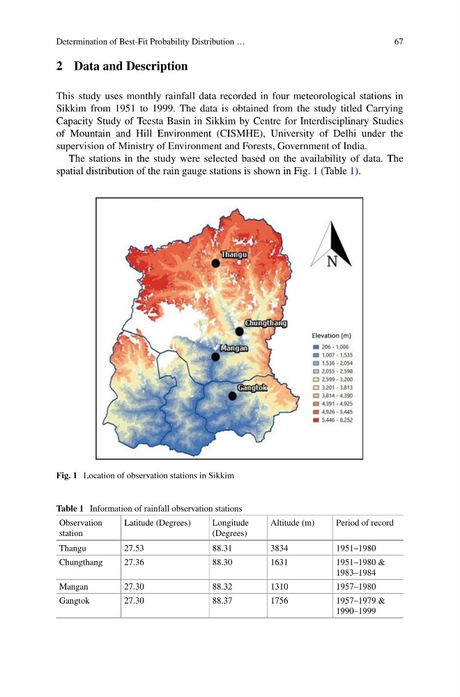
spatial distribution of the rain gauge stations is shown in Fig. 1 (Table 1).
Fig. 1 Location of observation stations in Sikkim
Table 1 Information of rainfall observation stations
Observation
station
Latitude (Degrees)
Longitude
(Degrees)
Altitude (m)
Period of record
Thangu
27.53
88.31
3834
1951–1980
Chungthang
27.36
88.30
1631
1951–1980 &
1983–1984
Mangan
27.30
88.32
1310
1957–1980
Gangtok
27.30
88.37
1756
1957–1979 &
1990–1999
67
2 Data and Description
This study uses monthly rainfall data recorded in four meteorological stations in
Sikkim from 1951 to 1999. The data is obtained from the study titled Carrying
Capacity Study of Teesta Basin in Sikkim by Centre for Interdisciplinary Studies
of Mountain and Hill Environment (CISMHE), University of Delhi under the
supervision of Ministry of Environment and Forests, Government of India.
The stations in the study were selected based on the availability of data. The
spatial distribution of the rain gauge stations is shown in Fig. 1 (Table 1).
Fig. 1 Location of observation stations in Sikkim
Table 1 Information of rainfall observation stations
Observation
station
Latitude (Degrees)
Longitude
(Degrees)
Altitude (m)
Period of record
Thangu
27.53
88.31
3834
1951–1980
Chungthang
27.36
88.30
1631
1951–1980 &
1983–1984
Mangan
27.30
88.32
1310
1957–1980
Gangtok
27.30
88.37
1756
1957–1979 &
1990–1999