

32
S. Mandal and S. Biswas
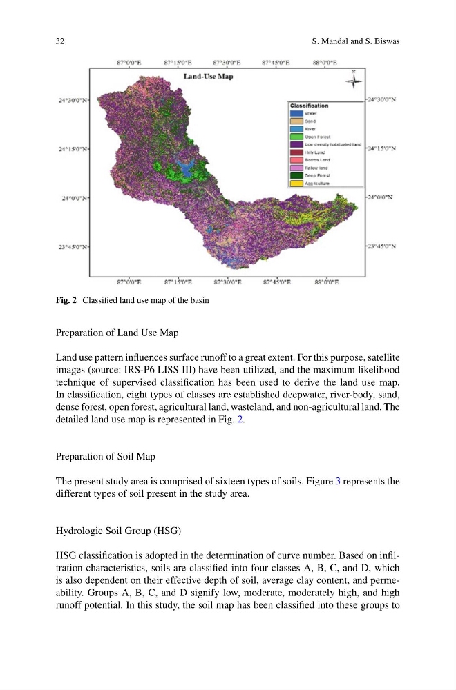
Fig. 2 Classified land use map of the basin
Preparation of Land Use Map
Land use pattern influences surface runoff to a great extent. For this purpose, satellite
images (source: IRS-P6 LISS III) have been utilized, and the maximum likelihood
technique of supervised classification has been used to derive the land use map.
In classification, eight types of classes are established deepwater, river-body, sand,
dense forest, open forest, agricultural land, wasteland, and non-agricultural land. The
detailed land use map is represented in Fig. 2.
Preparation of Soil Map
The present study area is comprised of sixteen types of soils. Figure 3 represents the
different types of soil present in the study area.
Hydrologic Soil Group (HSG)
HSG classification is adopted in the determination of curve number. Based on infiltration characteristics, soils are classified into four classes A, B, C, and D, which
is also dependent on their effective depth of soil, average clay content, and permeability. Groups A, B, C, and D signify low, moderate, moderately high, and high
runoff potential. In this study, the soil map has been classified into these groups to
S. Mandal and S. Biswas
Fig. 2 Classified land use map of the basin
Preparation of Land Use Map
Land use pattern influences surface runoff to a great extent. For this purpose, satellite
images (source: IRS-P6 LISS III) have been utilized, and the maximum likelihood
technique of supervised classification has been used to derive the land use map.
In classification, eight types of classes are established deepwater, river-body, sand,
dense forest, open forest, agricultural land, wasteland, and non-agricultural land. The
detailed land use map is represented in Fig. 2.
Preparation of Soil Map
The present study area is comprised of sixteen types of soils. Figure 3 represents the
different types of soil present in the study area.
Hydrologic Soil Group (HSG)
HSG classification is adopted in the determination of curve number. Based on infiltration characteristics, soils are classified into four classes A, B, C, and D, which
is also dependent on their effective depth of soil, average clay content, and permeability. Groups A, B, C, and D signify low, moderate, moderately high, and high
runoff potential. In this study, the soil map has been classified into these groups to