

200
S. K. Lahiri et al.
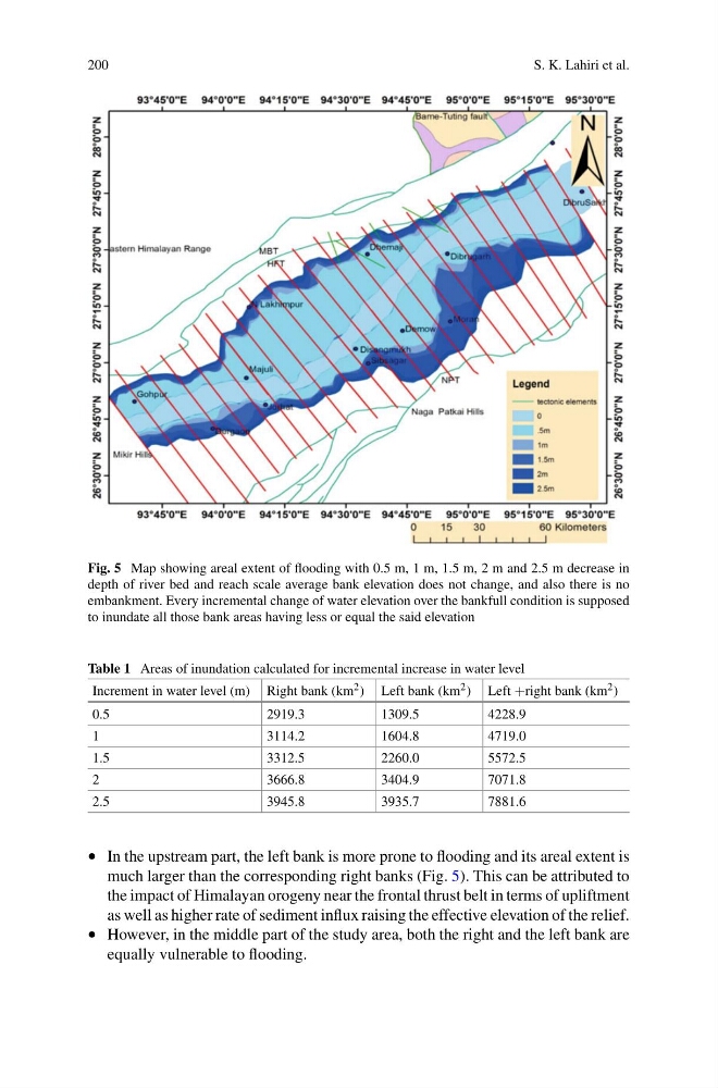
Fig. 5 Map showing areal extent of flooding with 0.5 m, 1 m, 1.5 m, 2 m and 2.5 m decrease in
depth of river bed and reach scale average bank elevation does not change, and also there is no
embankment. Every incremental change of water elevation over the bankfull condition is supposed
to inundate all those bank areas having less or equal the said elevation
Table 1 Areas of inundation calculated for incremental increase in water level
Increment in water level (m) Right bank (km 2 ) Left bank (km 2 ) Left +right bank (km 2 )
0.5
2919.3
1309.5
4228.9
1
3114.2
1604.8
4719.0
1.5
3312.5
2260.0
5572.5
2
3666.8
3404.9
7071.8
2.5
3945.8
3935.7
7881.6
• In the upstream part, the left bank is more prone to flooding and its areal extent is
much larger than the corresponding right banks (Fig. 5). This can be attributed to
the impact of Himalayan orogeny near the frontal thrust belt in terms of upliftment
as well as higher rate of sediment influx raising the effective elevation of the relief.
• However, in the middle part of the study area, both the right and the left bank are
equally vulnerable to flooding.
S. K. Lahiri et al.
Fig. 5 Map showing areal extent of flooding with 0.5 m, 1 m, 1.5 m, 2 m and 2.5 m decrease in
depth of river bed and reach scale average bank elevation does not change, and also there is no
embankment. Every incremental change of water elevation over the bankfull condition is supposed
to inundate all those bank areas having less or equal the said elevation
Table 1 Areas of inundation calculated for incremental increase in water level
Increment in water level (m) Right bank (km 2 ) Left bank (km 2 ) Left +right bank (km 2 )
0.5
2919.3
1309.5
4228.9
1
3114.2
1604.8
4719.0
1.5
3312.5
2260.0
5572.5
2
3666.8
3404.9
7071.8
2.5
3945.8
3935.7
7881.6
• In the upstream part, the left bank is more prone to flooding and its areal extent is
much larger than the corresponding right banks (Fig. 5). This can be attributed to
the impact of Himalayan orogeny near the frontal thrust belt in terms of upliftment
as well as higher rate of sediment influx raising the effective elevation of the relief.
• However, in the middle part of the study area, both the right and the left bank are
equally vulnerable to flooding.