

184
A. Shrestha et al.
1 Introduction
Flood is a natural and perennial phenomenon which is beneficial for enhancing
the soil fertility [1] and also a hazard endangering the human life, property, and
environment which is induced by natural or anthropogenic activities [2]. Due to
fragile topography and young geology, active seismic plates, occasional glacier
lake outburst floods, and concentrated monsoon rains, Nepal is observing significant water-induced disasters such as soil erosion, landslides, debris flow, flood, and
bank erosion. Globally, Nepal lies in 13th rank in terms of flood vulnerability [3].
This study concentrates on the Seti Sub-river basin and its impact in the Pokhara
Metropolitan City. The city is located nearly at the middle of the Gandaki Province
(Province No. 4), which lies between latitude 28°4
50
N to 28°20
40
N and longitude 83°48
00
E to 84°09
00
E, and has an area of 464.24 km
2 and population of
4,02,995. Pokhara Metropolitan City has Madi and Rupa Rural Municipality on the
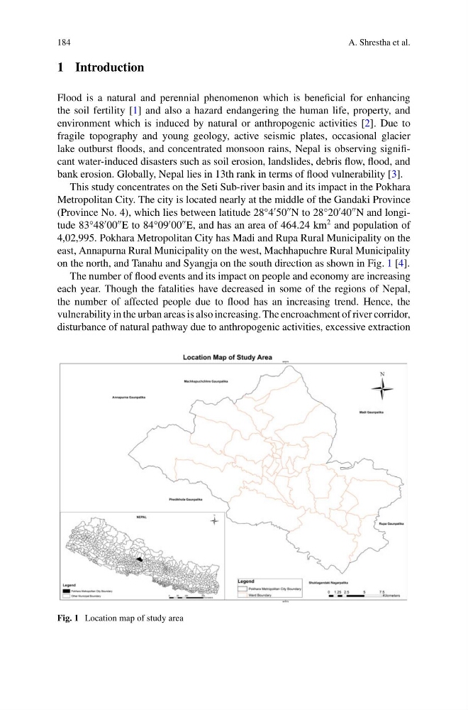
east, Annapurna Rural Municipality on the west, Machhapuchre Rural Municipality
on the north, and Tanahu and Syangja on the south direction as shown in Fig. 1 [4].
The number of flood events and its impact on people and economy are increasing
each year. Though the fatalities have decreased in some of the regions of Nepal,
the number of affected people due to flood has an increasing trend. Hence, the
vulnerability in the urban areas is also increasing. The encroachment of river corridor,
disturbance of natural pathway due to anthropogenic activities, excessive extraction
Fig. 1 Location map of study area
A. Shrestha et al.
1 Introduction
Flood is a natural and perennial phenomenon which is beneficial for enhancing
the soil fertility [1] and also a hazard endangering the human life, property, and
environment which is induced by natural or anthropogenic activities [2]. Due to
fragile topography and young geology, active seismic plates, occasional glacier
lake outburst floods, and concentrated monsoon rains, Nepal is observing significant water-induced disasters such as soil erosion, landslides, debris flow, flood, and
bank erosion. Globally, Nepal lies in 13th rank in terms of flood vulnerability [3].
This study concentrates on the Seti Sub-river basin and its impact in the Pokhara
Metropolitan City. The city is located nearly at the middle of the Gandaki Province
(Province No. 4), which lies between latitude 28°4
50
N to 28°20
40
N and longitude 83°48
00
E to 84°09
00
E, and has an area of 464.24 km
2 and population of
4,02,995. Pokhara Metropolitan City has Madi and Rupa Rural Municipality on the
east, Annapurna Rural Municipality on the west, Machhapuchre Rural Municipality
on the north, and Tanahu and Syangja on the south direction as shown in Fig. 1 [4].
The number of flood events and its impact on people and economy are increasing
each year. Though the fatalities have decreased in some of the regions of Nepal,
the number of affected people due to flood has an increasing trend. Hence, the
vulnerability in the urban areas is also increasing. The encroachment of river corridor,
disturbance of natural pathway due to anthropogenic activities, excessive extraction
Fig. 1 Location map of study area