

Water Pipeline Routing …
103
2 Methodology
Long distance pipelines are complex arrangements in the specific GIS fields. For
determining the more appropriate routing way, it is needed to find a geographic
location closer to the study area. In this study, it was found to be in Hanumangarh
district on Indira Gandhi Canal. The methodology followed to find the most cost
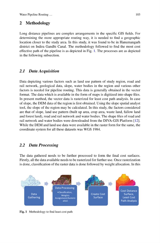
effective path of the pipeline is as depicted in Fig. 1. The processes are as depicted
in the following subsection.
2.1 Data Acquisition
Data depicting various factors such as land use pattern of study region, road and
rail network, geological data, slope, water bodies in the region and various other
factors is needed for pipeline routing. This data is generally obtained in the vector
format. The data which is available in the form of maps is digitized into shape files.
In present method, the vector data is rasterized for least cost path analysis. In case
of slope, the DEM data of the region is first obtained. Using the slope spatial analyst
tool, the slope of the region may be calculated. In this study, the factors considered
are that of slope, land use pattern (built up area, crop area, waste land, fallow land
and forest land), road and rail network and water bodies. The shape files of road and
rail network and water bodies were downloaded from the DIVA-GIS Platform [12].
While the DEM and land use data were available in the raster form for the same, the
coordinate system for all these datasets was WGS 1984.
2.2 Data Processing
The data gathered needs to be further processed to form the final cost surfaces.
Firstly, all the data available needs to be rasterized for further use. Once rasterization
is done, classification of the raster data is done followed by weight allocation. In this
Fig. 1 Methodology to find least cost path
103
2 Methodology
Long distance pipelines are complex arrangements in the specific GIS fields. For
determining the more appropriate routing way, it is needed to find a geographic
location closer to the study area. In this study, it was found to be in Hanumangarh
district on Indira Gandhi Canal. The methodology followed to find the most cost
effective path of the pipeline is as depicted in Fig. 1. The processes are as depicted
in the following subsection.
2.1 Data Acquisition
Data depicting various factors such as land use pattern of study region, road and
rail network, geological data, slope, water bodies in the region and various other
factors is needed for pipeline routing. This data is generally obtained in the vector
format. The data which is available in the form of maps is digitized into shape files.
In present method, the vector data is rasterized for least cost path analysis. In case
of slope, the DEM data of the region is first obtained. Using the slope spatial analyst
tool, the slope of the region may be calculated. In this study, the factors considered
are that of slope, land use pattern (built up area, crop area, waste land, fallow land
and forest land), road and rail network and water bodies. The shape files of road and
rail network and water bodies were downloaded from the DIVA-GIS Platform [12].
While the DEM and land use data were available in the raster form for the same, the
coordinate system for all these datasets was WGS 1984.
2.2 Data Processing
The data gathered needs to be further processed to form the final cost surfaces.
Firstly, all the data available needs to be rasterized for further use. Once rasterization
is done, classification of the raster data is done followed by weight allocation. In this
Fig. 1 Methodology to find least cost path