

84
D. Ghose et al.
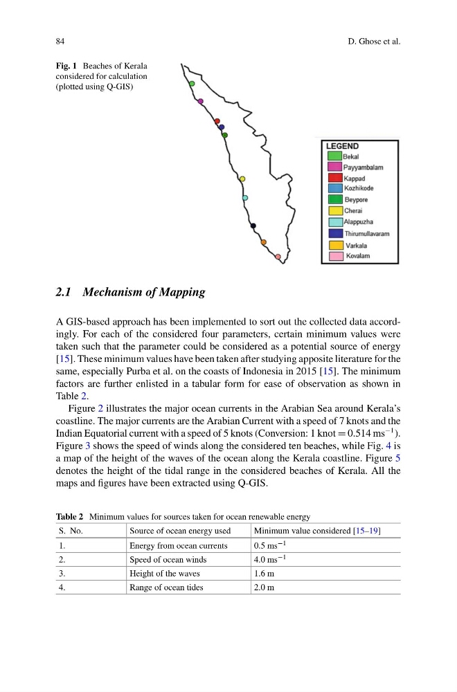
Fig. 1 Beaches of Kerala
considered for calculation
(plotted using Q-GIS)
2.1 Mechanism of Mapping
A GIS-based approach has been implemented to sort out the collected data accordingly. For each of the considered four parameters, certain minimum values were
taken such that the parameter could be considered as a potential source of energy
[15]. These minimum values have been taken after studying apposite literature for the
same, especially Purba et al. on the coasts of Indonesia in 2015 [15]. The minimum
factors are further enlisted in a tabular form for ease of observation as shown in
Table 2.
Figure 2 illustrates the major ocean currents in the Arabian Sea around Kerala’s
coastline. The major currents are the Arabian Current with a speed of 7 knots and the
Indian Equatorial current with a speed of 5 knots (Conversion: 1 knot = 0.514 ms
−1 ).
Figure 3 shows the speed of winds along the considered ten beaches, while Fig. 4 is
a map of the height of the waves of the ocean along the Kerala coastline. Figure 5
denotes the height of the tidal range in the considered beaches of Kerala. All the
maps and figures have been extracted using Q-GIS.
Table 2 Minimum values for sources taken for ocean renewable energy
S. No.
Source of ocean energy used
Minimum value considered [15–19]
1.
Energy from ocean currents
0.5 ms −1
2.
Speed of ocean winds
4.0 ms −1
3.
Height of the waves
1.6 m
4.
Range of ocean tides
2.0 m
D. Ghose et al.
Fig. 1 Beaches of Kerala
considered for calculation
(plotted using Q-GIS)
2.1 Mechanism of Mapping
A GIS-based approach has been implemented to sort out the collected data accordingly. For each of the considered four parameters, certain minimum values were
taken such that the parameter could be considered as a potential source of energy
[15]. These minimum values have been taken after studying apposite literature for the
same, especially Purba et al. on the coasts of Indonesia in 2015 [15]. The minimum
factors are further enlisted in a tabular form for ease of observation as shown in
Table 2.
Figure 2 illustrates the major ocean currents in the Arabian Sea around Kerala’s
coastline. The major currents are the Arabian Current with a speed of 7 knots and the
Indian Equatorial current with a speed of 5 knots (Conversion: 1 knot = 0.514 ms
−1 ).
Figure 3 shows the speed of winds along the considered ten beaches, while Fig. 4 is
a map of the height of the waves of the ocean along the Kerala coastline. Figure 5
denotes the height of the tidal range in the considered beaches of Kerala. All the
maps and figures have been extracted using Q-GIS.
Table 2 Minimum values for sources taken for ocean renewable energy
S. No.
Source of ocean energy used
Minimum value considered [15–19]
1.
Energy from ocean currents
0.5 ms −1
2.
Speed of ocean winds
4.0 ms −1
3.
Height of the waves
1.6 m
4.
Range of ocean tides
2.0 m