

294
5 X-ray Pulsar-Based Navigation: Theories and Experiments
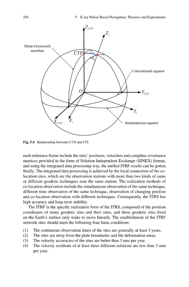
Fig. 5.4 Relationship between CTS and ITS
each reference frame include the sites’ positions, velocities and complete covariance
matrices provided in the form of Solution Independent Exchange (SINEX) format,
and using the integrated data processing way, the unified ITRF results can be gotten
finally. The integrated data processing is achieved by the local connection of the colocation sites, which are the observation stations with more than two kinds of same
or different geodetic techniques near the same station. The realization methods of
co-location observation include the simultaneous observation of the same technique,
different time observation of the same technique, observation of changing position
and co-location observation with different techniques. Consequently, the ITRS has
high accuracy and long-term stability.
The ITRF is the specific realization form of the ITRS, composed of the position
coordinates of many geodetic sites and their rates, and these geodetic sites fixed
on the Earth’s surface only make to move linearly. The establishment of the ITRF
network sites should meet the following four basic conditions:
(1) The continuous observation times of the sites are generally at least 3 years.
(2) The sites are away from the plate boundaries and the deformation areas.
(3) The velocity accuracies of the sites are better than 3 mm per year.
(4) The velocity residuals of at least three different solutions are less than 3 mm
per year.
5 X-ray Pulsar-Based Navigation: Theories and Experiments
Fig. 5.4 Relationship between CTS and ITS
each reference frame include the sites’ positions, velocities and complete covariance
matrices provided in the form of Solution Independent Exchange (SINEX) format,
and using the integrated data processing way, the unified ITRF results can be gotten
finally. The integrated data processing is achieved by the local connection of the colocation sites, which are the observation stations with more than two kinds of same
or different geodetic techniques near the same station. The realization methods of
co-location observation include the simultaneous observation of the same technique,
different time observation of the same technique, observation of changing position
and co-location observation with different techniques. Consequently, the ITRS has
high accuracy and long-term stability.
The ITRF is the specific realization form of the ITRS, composed of the position
coordinates of many geodetic sites and their rates, and these geodetic sites fixed
on the Earth’s surface only make to move linearly. The establishment of the ITRF
network sites should meet the following four basic conditions:
(1) The continuous observation times of the sites are generally at least 3 years.
(2) The sites are away from the plate boundaries and the deformation areas.
(3) The velocity accuracies of the sites are better than 3 mm per year.
(4) The velocity residuals of at least three different solutions are less than 3 mm
per year.