

54
5 Spheres and Coordinates
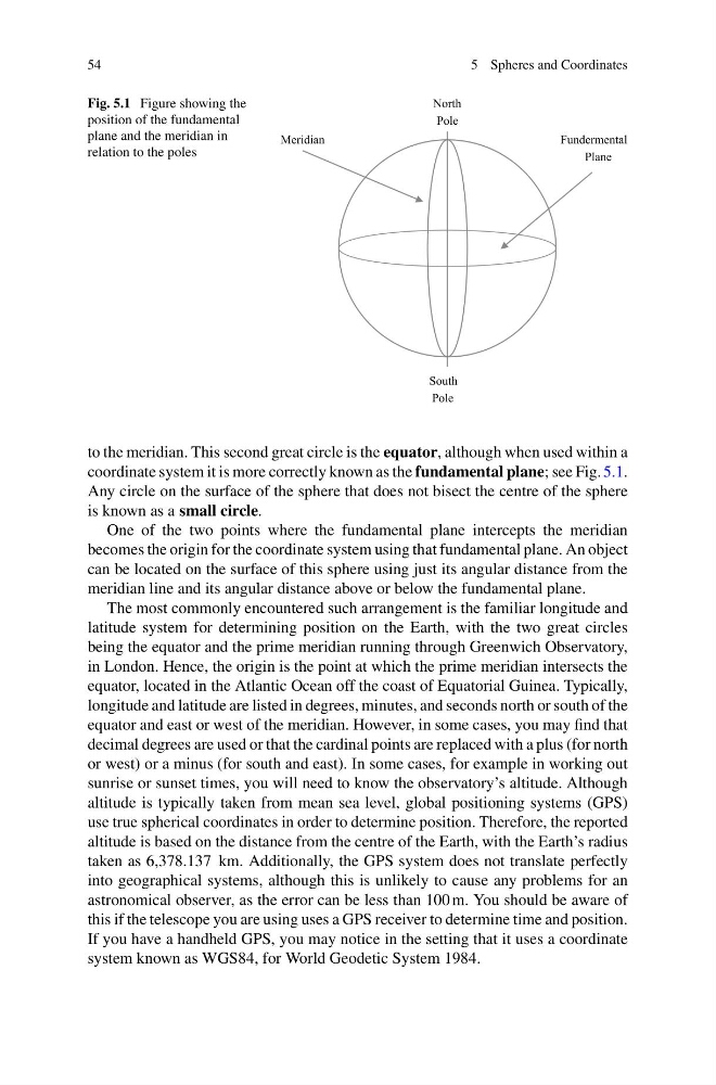
Fig. 5.1 Figure showing the
position of the fundamental
plane and the meridian in
relation to the poles
to the meridian. This second great circle is the equator, although when used within a
coordinate system it is more correctly known as the fundamental plane; see Fig. 5.1.
Any circle on the surface of the sphere that does not bisect the centre of the sphere
is known as a small circle.
One of the two points where the fundamental plane intercepts the meridian
becomes the origin for the coordinate system using that fundamental plane. An object
can be located on the surface of this sphere using just its angular distance from the
meridian line and its angular distance above or below the fundamental plane.
The most commonly encountered such arrangement is the familiar longitude and
latitude system for determining position on the Earth, with the two great circles
being the equator and the prime meridian running through Greenwich Observatory,
in London. Hence, the origin is the point at which the prime meridian intersects the
equator, located in the Atlantic Ocean off the coast of Equatorial Guinea. Typically,
longitude and latitude are listed in degrees, minutes, and seconds north or south of the
equator and east or west of the meridian. However, in some cases, you may find that
decimal degrees are used or that the cardinal points are replaced with a plus (for north
or west) or a minus (for south and east). In some cases, for example in working out
sunrise or sunset times, you will need to know the observatory’s altitude. Although
altitude is typically taken from mean sea level, global positioning systems (GPS)
use true spherical coordinates in order to determine position. Therefore, the reported
altitude is based on the distance from the centre of the Earth, with the Earth’s radius
taken as 6,378.137 km. Additionally, the GPS system does not translate perfectly
into geographical systems, although this is unlikely to cause any problems for an
astronomical observer, as the error can be less than 100 m. You should be aware of
this if the telescope you are using uses a GPS receiver to determine time and position.
If you have a handheld GPS, you may notice in the setting that it uses a coordinate
system known as WGS84, for World Geodetic System 1984.
5 Spheres and Coordinates
Fig. 5.1 Figure showing the
position of the fundamental
plane and the meridian in
relation to the poles
to the meridian. This second great circle is the equator, although when used within a
coordinate system it is more correctly known as the fundamental plane; see Fig. 5.1.
Any circle on the surface of the sphere that does not bisect the centre of the sphere
is known as a small circle.
One of the two points where the fundamental plane intercepts the meridian
becomes the origin for the coordinate system using that fundamental plane. An object
can be located on the surface of this sphere using just its angular distance from the
meridian line and its angular distance above or below the fundamental plane.
The most commonly encountered such arrangement is the familiar longitude and
latitude system for determining position on the Earth, with the two great circles
being the equator and the prime meridian running through Greenwich Observatory,
in London. Hence, the origin is the point at which the prime meridian intersects the
equator, located in the Atlantic Ocean off the coast of Equatorial Guinea. Typically,
longitude and latitude are listed in degrees, minutes, and seconds north or south of the
equator and east or west of the meridian. However, in some cases, you may find that
decimal degrees are used or that the cardinal points are replaced with a plus (for north
or west) or a minus (for south and east). In some cases, for example in working out
sunrise or sunset times, you will need to know the observatory’s altitude. Although
altitude is typically taken from mean sea level, global positioning systems (GPS)
use true spherical coordinates in order to determine position. Therefore, the reported
altitude is based on the distance from the centre of the Earth, with the Earth’s radius
taken as 6,378.137 km. Additionally, the GPS system does not translate perfectly
into geographical systems, although this is unlikely to cause any problems for an
astronomical observer, as the error can be less than 100 m. You should be aware of
this if the telescope you are using uses a GPS receiver to determine time and position.
If you have a handheld GPS, you may notice in the setting that it uses a coordinate
system known as WGS84, for World Geodetic System 1984.