

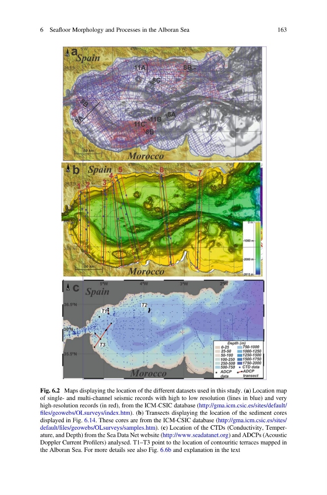
Fig. 6.2 Maps displaying the location of the different datasets used in this study. (a) Location map
of single- and multi-channel seismic records with high to low resolution (lines in blue) and very
high-resolution records (in red), from the ICM-CSIC database (http://gma.icm.csic.es/sites/default/
files/geowebs/OLsurveys/index.htm). (b) Transects displaying the location of the sediment cores
displayed in Fig. 6.14. These cores are from the ICM-CSIC database (http://gma.icm.csic.es/sites/
default/files/geowebs/OLsurveys/samples.htm). (c) Location of the CTDs (Conductivity, Temperature, and Depth) from the Sea Data Net website (http://www.seadatanet.org) and ADCPs (Acoustic
Doppler Current Profilers) analysed. T1–T3 point to the location of contouritic terraces mapped in
the Alboran Sea. For more details see also Fig. 6.6b and explanation in the text
6 Seafloor Morphology and Processes in the Alboran Sea
163
of single- and multi-channel seismic records with high to low resolution (lines in blue) and very
high-resolution records (in red), from the ICM-CSIC database (http://gma.icm.csic.es/sites/default/
files/geowebs/OLsurveys/index.htm). (b) Transects displaying the location of the sediment cores
displayed in Fig. 6.14. These cores are from the ICM-CSIC database (http://gma.icm.csic.es/sites/
default/files/geowebs/OLsurveys/samples.htm). (c) Location of the CTDs (Conductivity, Temperature, and Depth) from the Sea Data Net website (http://www.seadatanet.org) and ADCPs (Acoustic
Doppler Current Profilers) analysed. T1–T3 point to the location of contouritic terraces mapped in
the Alboran Sea. For more details see also Fig. 6.6b and explanation in the text
6 Seafloor Morphology and Processes in the Alboran Sea
163