

368
M. Weber and E. A. Lee
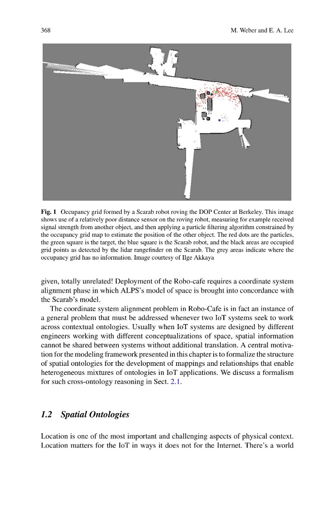
Fig. 1 Occupancy grid formed by a Scarab robot roving the DOP Center at Berkeley. This image
shows use of a relatively poor distance sensor on the roving robot, measuring for example received
signal strength from another object, and then applying a particle filtering algorithm constrained by
the occupancy grid map to estimate the position of the other object. The red dots are the particles,
the green square is the target, the blue square is the Scarab robot, and the black areas are occupied
grid points as detected by the lidar rangefinder on the Scarab. The grey areas indicate where the
occupancy grid has no information. Image courtesy of Ilge Akkaya
given, totally unrelated! Deployment of the Robo-cafe requires a coordinate system
alignment phase in which ALPS’s model of space is brought into concordance with
the Scarab’s model.
The coordinate system alignment problem in Robo-Cafe is in fact an instance of
a general problem that must be addressed whenever two IoT systems seek to work
across contextual ontologies. Usually when IoT systems are designed by different
engineers working with different conceptualizations of space, spatial information
cannot be shared between systems without additional translation. A central motivation for the modeling framework presented in this chapter is to formalize the structure
of spatial ontologies for the development of mappings and relationships that enable
heterogeneous mixtures of ontologies in IoT applications. We discuss a formalism
for such cross-ontology reasoning in Sect. 2.1.
1.2 Spatial Ontologies
Location is one of the most important and challenging aspects of physical context.
Location matters for the IoT in ways it does not for the Internet. There’s a world
M. Weber and E. A. Lee
Fig. 1 Occupancy grid formed by a Scarab robot roving the DOP Center at Berkeley. This image
shows use of a relatively poor distance sensor on the roving robot, measuring for example received
signal strength from another object, and then applying a particle filtering algorithm constrained by
the occupancy grid map to estimate the position of the other object. The red dots are the particles,
the green square is the target, the blue square is the Scarab robot, and the black areas are occupied
grid points as detected by the lidar rangefinder on the Scarab. The grey areas indicate where the
occupancy grid has no information. Image courtesy of Ilge Akkaya
given, totally unrelated! Deployment of the Robo-cafe requires a coordinate system
alignment phase in which ALPS’s model of space is brought into concordance with
the Scarab’s model.
The coordinate system alignment problem in Robo-Cafe is in fact an instance of
a general problem that must be addressed whenever two IoT systems seek to work
across contextual ontologies. Usually when IoT systems are designed by different
engineers working with different conceptualizations of space, spatial information
cannot be shared between systems without additional translation. A central motivation for the modeling framework presented in this chapter is to formalize the structure
of spatial ontologies for the development of mappings and relationships that enable
heterogeneous mixtures of ontologies in IoT applications. We discuss a formalism
for such cross-ontology reasoning in Sect. 2.1.
1.2 Spatial Ontologies
Location is one of the most important and challenging aspects of physical context.
Location matters for the IoT in ways it does not for the Internet. There’s a world