

4 Climate Change and Water Resources in West Africa …
61
Table 1 (continued)
Country
Station
Latitude
Longitude Altitude (m) Type of station
Tambacounda
13° 46’ N 13° 41’ W
49
Synoptic
Ziguinchor
12° 33’ N 16° 16’ W
26
Synoptic
Kolda
12° 53’ N 14° 58’ W
35
Synoptic
Kédougou
12° 34’ N 12° 13’ W 165
Synoptic
(ORSTOM 1973)
U t,T =
t
i=1
T
j=t+1
D i j
(2)
where
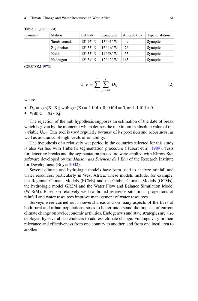
• D ij = sgn(Xi-Xj) with sgn(X) = 1 if d > 0; 0 if d = 0, and -1 if d < 0.
• With d = Xi - Xj.
The rejection of the null hypothesis supposes an estimation of the date of break
which is given by the moment t which defines the maximum in absolute value of the
variable U t , T . This tool is used regularly because of its precision and robustness, as
well as assurance of high levels of reliability.
The hypothesis of a relatively wet period in the countries selected for this study
is also verified with Hubert’s segmentation procedure (Hubert et al. 1989). Tests
for detecting breaks and the segmentation procedure were applied with KhronoStat
software developed by the Maison des Sciences de l’Eau of the Research Institute
for Development (Boyer 2002).
Several climate and hydrologic models have been used to analyze rainfall and
water resources, particularly in West Africa. These models include, for example,
the Regional Climate Models (RCMs) and the Global Climate Models (GCMs),
the hydrologic model GR2M and the Water Flow and Balance Simulation Model
(WaSiM). Based on relatively well-calibrated reference situations, projections of
rainfall and water resources improve management of water resources.
Surveys were carried out in several areas and on many aspects of the lives of
both rural and urban populations, so as to better understand the impacts of current
climate change on socioeconomic activities. Endogenous and state strategies are also
deployed by several stakeholders to address climate change. Findings vary in their
relevance and effectiveness from one country to another, and from one local area to
another.
61
Table 1 (continued)
Country
Station
Latitude
Longitude Altitude (m) Type of station
Tambacounda
13° 46’ N 13° 41’ W
49
Synoptic
Ziguinchor
12° 33’ N 16° 16’ W
26
Synoptic
Kolda
12° 53’ N 14° 58’ W
35
Synoptic
Kédougou
12° 34’ N 12° 13’ W 165
Synoptic
(ORSTOM 1973)
U t,T =
t
i=1
T
j=t+1
D i j
(2)
where
• D ij = sgn(Xi-Xj) with sgn(X) = 1 if d > 0; 0 if d = 0, and -1 if d < 0.
• With d = Xi - Xj.
The rejection of the null hypothesis supposes an estimation of the date of break
which is given by the moment t which defines the maximum in absolute value of the
variable U t , T . This tool is used regularly because of its precision and robustness, as
well as assurance of high levels of reliability.
The hypothesis of a relatively wet period in the countries selected for this study
is also verified with Hubert’s segmentation procedure (Hubert et al. 1989). Tests
for detecting breaks and the segmentation procedure were applied with KhronoStat
software developed by the Maison des Sciences de l’Eau of the Research Institute
for Development (Boyer 2002).
Several climate and hydrologic models have been used to analyze rainfall and
water resources, particularly in West Africa. These models include, for example,
the Regional Climate Models (RCMs) and the Global Climate Models (GCMs),
the hydrologic model GR2M and the Water Flow and Balance Simulation Model
(WaSiM). Based on relatively well-calibrated reference situations, projections of
rainfall and water resources improve management of water resources.
Surveys were carried out in several areas and on many aspects of the lives of
both rural and urban populations, so as to better understand the impacts of current
climate change on socioeconomic activities. Endogenous and state strategies are also
deployed by several stakeholders to address climate change. Findings vary in their
relevance and effectiveness from one country to another, and from one local area to
another.