

the tropics on a global scale. For this purpose, multiple microsatellites, perhaps as
many as ten, must be operated in equatorial orbit (Fig. 5.17). However, due to the
decreasing size of microsatellites and their lower manufacturing costs,
microsatellites could be realized at a lower cost than a typical large-scale satellite
system. The concept of the equator orbiter observation system with computerized
analysis is the only way to collect real-time or semi-real-time observations of the
world’s tropical regions, which have been difficult to observe in the past due to
abundant rainfall and cloud cover.
International Equator observation system (iEOS): finally, we propose the “international Equator observation system (iEOS),” which is composed of several sensing
systems. However, in future, the minimum unit should consist of the hypersensor,
PALSAR, 3D photogrammetry, and GHG sensor. The iEOS is necessary because
the Equator and tropics are the key to Earth (planetary) boundary conservation, most
dynamic ecosystems, and a few sensing scenes covered by heavy clouds.
iEOS should cover key GIS data in (semi-)real-time, and therefore, iEOS is
expected to contribute to evaluation of following the inventory parameters in the
tropics.
• Ecological Footprint (Rees 1992)
https://www.footprintnetwork.org
• Planetary Boundary (Rockström et al. 2009a, b; Steffen et al. 2015; Nash et al.
2017)
Equator
Drone
UAV
Balloon
Micro-satellite
Tropics
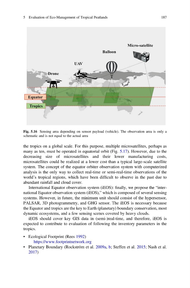
Fig. 5.16 Sensing area depending on sensor payload (vehicle). The observation area is only a
schematic and is not equal to the actual area
5 Evaluation of Eco-Management of Tropical Peatlands
187
many as ten, must be operated in equatorial orbit (Fig. 5.17). However, due to the
decreasing size of microsatellites and their lower manufacturing costs,
microsatellites could be realized at a lower cost than a typical large-scale satellite
system. The concept of the equator orbiter observation system with computerized
analysis is the only way to collect real-time or semi-real-time observations of the
world’s tropical regions, which have been difficult to observe in the past due to
abundant rainfall and cloud cover.
International Equator observation system (iEOS): finally, we propose the “international Equator observation system (iEOS),” which is composed of several sensing
systems. However, in future, the minimum unit should consist of the hypersensor,
PALSAR, 3D photogrammetry, and GHG sensor. The iEOS is necessary because
the Equator and tropics are the key to Earth (planetary) boundary conservation, most
dynamic ecosystems, and a few sensing scenes covered by heavy clouds.
iEOS should cover key GIS data in (semi-)real-time, and therefore, iEOS is
expected to contribute to evaluation of following the inventory parameters in the
tropics.
• Ecological Footprint (Rees 1992)
https://www.footprintnetwork.org
• Planetary Boundary (Rockström et al. 2009a, b; Steffen et al. 2015; Nash et al.
2017)
Equator
Drone
UAV
Balloon
Micro-satellite
Tropics
Fig. 5.16 Sensing area depending on sensor payload (vehicle). The observation area is only a
schematic and is not equal to the actual area
5 Evaluation of Eco-Management of Tropical Peatlands
187